
 Gilserberg
Berlin
Bordesholm
Bechtolsheim
Aub
Triptis
Heppenheim
Biblis
Angermünde
Gilserberg
Berlin
Bordesholm
Bechtolsheim
Aub
Triptis
Heppenheim
Biblis
Angermünde
Gustav-Clauss-Anlage on the map, Sankt Ingbert, Germany
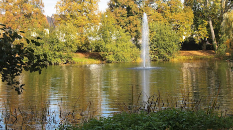
Photo
Where is located Gustav-Clauss-Anlage
Gustav-Clauss-Anlage — local attraction, which is located at 66386 Sankt Ingbert, Germany and belongs to the category — state park. Average visitor rating for this place — 4.1 (according to 475 ratings, information from open sources and relevant for 2022).
Exact location — Gustav-Clauss-Anlage, marked on the map with a red marker.
You can get directions to Gustav-Clauss-Anlage on the map from your location.
What else is interesting in Sankt Ingbert? You can see all the sights if you go to the city page.
Coordinates
Gustav-Clauss-Anlage, Germany coordinates in decimal format: latitude — 49.2829499852954, longitude — 7.1201243252388595. When converted to degrees, minutes, seconds Gustav-Clauss-Anlage has the following coordinates: 49°16′58.62 north latitude and 7°7′12.45 east longitude.
Nearby cities
The largest cities that are located nearby:
- Saarbrücken — 9 km
- Trier — 62 km
- Metz
 (France) — 70 km
 - Strasbourg (France) — 91 km
- Nancy (France) — 94 km
- Ludwigshafen — 98 km
- Karlsruhe — 98 km
- Mannheim — 100 km
- Mainz — 113 km
- Heidelberg — 113 km
- Wiesbaden — 119 km
- Pforzheim — 123 km
- Koblenz — 124 km
- Darmstadt — 128 km
- Frankfurt — 145 km
- Offenbach — 149 km
- Freiburg — 151 km
- Heilbronn — 153 km
- Stuttgart — 161 km
Distance to the capital
Distance to the capital (Berlin) is about — 569 km.