
 Gilserberg
Berlin
Bordesholm
Bechtolsheim
Aub
Triptis
Heppenheim
Biblis
Angermünde
Gilserberg
Berlin
Bordesholm
Bechtolsheim
Aub
Triptis
Heppenheim
Biblis
Angermünde
Burg Stolzenberg on the map, Bad Soden-Salmünster, Germany
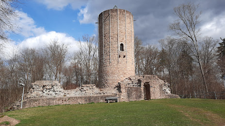
Photo
Where is located Burg Stolzenberg
Burg Stolzenberg — local attraction, which is located at Romsthaler Str. 42A, 63628 Bad Soden-Salmünster, Germany and belongs to the category — historical landmark. Average visitor rating for this place — 4.4 (according to 213 ratings, information from open sources and relevant for 2022).
Exact location — Burg Stolzenberg, marked on the map with a red marker.
You can get directions to Burg Stolzenberg on the map from your location.
What else is interesting in Bad Soden-Salmünster? You can see all the sights if you go to the city page.
Coordinates
Burg Stolzenberg, Germany coordinates in decimal format: latitude — 50.2908349339644, longitude — 9.368153825275058. When converted to degrees, minutes, seconds Burg Stolzenberg has the following coordinates: 50°17′27.01 north latitude and 9°22′5.35 east longitude.
Nearby cities
The largest cities that are located nearby:
- Offenbach — 47 km
- Frankfurt — 52 km
- Würzburg — 68 km
- Darmstadt — 68 km
- Wiesbaden — 83 km
- Mainz — 86 km
- Mannheim — 109 km
- Heidelberg — 109 km
- Ludwigshafen — 110 km
- Kassel — 115 km
- Siegen — 116 km
- Heilbronn — 126 km
- Koblenz — 126 km
- Erfurt — 140 km
- Erlangen — 140 km
- Göttingen — 145 km
- Fürth — 146 km
- Nuremberg — 153 km
- Karlsruhe — 157 km
Distance to the capital
Distance to the capital (Berlin) is about — 374 km.