
 Puerto de la Duquesa
La Serna de Iguña
Pumalverde
Puentenansa
La Iglesia
Casar de Periedo
Fuengirola
Renedo de Piélagos
Villabanez
Puerto de la Duquesa
La Serna de Iguña
Pumalverde
Puentenansa
La Iglesia
Casar de Periedo
Fuengirola
Renedo de Piélagos
Villabanez
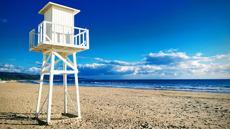
Playa del Carmen on the map, Vejer de la Frontera, Spain
Photo
Where is located Playa del Carmen
Playa del Carmen — local attraction, which is located at no data and belongs to the category — -. Average visitor rating for this place — 4.5 (according to 134 ratings, information from open sources and relevant for 2022).
Exact location — Playa del Carmen, marked on the map with a red marker.
You can get directions to Playa del Carmen on the map from your location.
What else is interesting in Vejer de la Frontera? You can see all the sights if you go to the city page.
Coordinates
Playa del Carmen, Spain coordinates in decimal format: latitude — 36.50355510002787, longitude — -6.2006060596312675. When converted to degrees, minutes, seconds Playa del Carmen has the following coordinates: 36°30′12.8 north latitude and -6°12′2.18 east longitude.
Nearby cities
The largest cities that are located nearby:
- Cádiz — 42 km
- Algeciras — 47 km
- Jerez — 50 km
- Tangier
 (Morocco) — 56 km
 - Tetouan (Morocco) — 93 km
- Marbella — 100 km
- Dos Hermanas — 114 km
- Málaga — 140 km
- Huelva — 141 km
- Córdoba — 208 km
- Taounate (Morocco) — 225 km
- Kenitra (Morocco) — 228 km
- Granada — 232 km
- Jaén — 255 km
- Sale (Morocco) — 256 km
- Meknes (Morocco) — 263 km
- Khemisset (Morocco) — 269 km
- Temara (Morocco) — 271 km
- Taza (Morocco) — 287 km
Distance to the capital
Distance to the capital (Madrid) is about — 486 km.