
 Manuel María Caballero
Santa Cruz Department
Pozo del Tigre
Motacucito
Colquiri
Inquisivi
Provincia de Andrés Ibáñez
Yacuíba
Tarija
Manuel María Caballero
Santa Cruz Department
Pozo del Tigre
Motacucito
Colquiri
Inquisivi
Provincia de Andrés Ibáñez
Yacuíba
Tarija
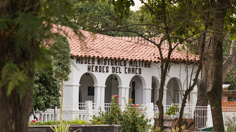
Museum of the Chaco War on the map, Villamontes, Bolivia
Photo
Where is located Museum of the Chaco War
Museum of the Chaco War — local attraction, which is located at PGQF+WR8, Villa Montes, Bolivia and belongs to the category — museum. Average visitor rating for this place — 4.3 (according to 178 ratings, information from open sources and relevant for 2022).
Exact location — Museum of the Chaco War, marked on the map with a red marker.
You can get directions to Museum of the Chaco War on the map from your location.
What else is interesting in Villamontes? You can see all the sights if you go to the city page.
Coordinates
Museum of the Chaco War, Bolivia coordinates in decimal format: latitude — -21.260252779199163, longitude — -63.47548367560855. When converted to degrees, minutes, seconds Museum of the Chaco War has the following coordinates: -21°15′36.91 north latitude and -63°28′31.74 east longitude.
Nearby cities
The largest cities that are located nearby:
- Tarija — 135 km
- Potosi — 304 km
- Sucre — 312 km
- San Salvador de Jujuy
 (Argentina) — 373 km
 - Santa Cruz de la Sierra — 379 km
- Salta (Argentina) — 436 km
- Cochabamba — 516 km
- Oruro — 531 km
- Calama
 (Chile) — 575 km
 - San Miguel de Tucuman (Argentina) — 637 km
- Iquique (Chile) — 704 km
- Santiago del Estero (Argentina) — 725 km
- Asuncion
 (Paraguay) — 732 km
 - Lambare (Paraguay) — 738 km
- Fernando De La Mora (Paraguay) — 741 km
- Luque (Paraguay) — 743 km
- San Lorenzo (Paraguay) — 744 km
- Antofagasta (Chile) — 752 km
- Capiata (Paraguay) — 752 km
Distance to the capital
Distance to the capital (Nuestra Señora de La Paz) is about — 723 km.