
 Norra Grean
Asslebyn
Gillanda
Ödebyn
Håltane
Torp
Tjärtakan
Flicksäter
Dykälla
Norra Grean
Asslebyn
Gillanda
Ödebyn
Håltane
Torp
Tjärtakan
Flicksäter
Dykälla
Garnsviken on the map, Vallentuna, Sweden
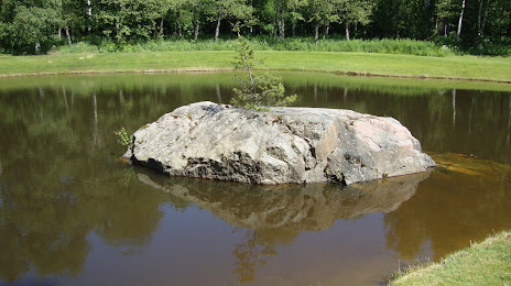
Photo
Where is located Garnsviken
Garnsviken — local attraction, which is located at no data and belongs to the category — -. Average visitor rating for this place — 4.1 (according to 26 ratings, information from open sources and relevant for 2022).
Exact location — Garnsviken, marked on the map with a red marker.
You can get directions to Garnsviken on the map from your location.
What else is interesting in Vallentuna? You can see all the sights if you go to the city page.
Coordinates
Garnsviken, Sweden coordinates in decimal format: latitude — 59.51459307569054, longitude — 18.271775134699148. When converted to degrees, minutes, seconds Garnsviken has the following coordinates: 59°30′52.54 north latitude and 18°16′18.39 east longitude.
Nearby cities
The largest cities that are located nearby:
- Stockholm — 23 km
- Uppsala — 43 km
- Västerås — 86 km
- Turku
 (Finland) — 250 km
 - Espoo (Finland) — 369 km
- Tampere (Finland) — 370 km
- Tallinn
 (Estonia) — 375 km
 - Helsinki (Finland) — 384 km
- Vantaa (Finland) — 390 km
- Oslo
 (Norway) — 408 km
 - Rīga
 (Latvia) — 462 km
 - Klaipėda
 (Lithuania) — 465 km
 - Šiauliai (Lithuania) — 513 km
- Tartu (Estonia) — 518 km
- Malmö — 538 km
- Copenhagen
 (Denmark) — 548 km
 - Kaliningrad
 (Russia) — 555 km
 - Gdynia
 (Poland) — 555 km
 - Aalborg (Denmark) — 562 km
Distance to the capital
Distance to the capital (Stockholm) is about — 29 km.