
 Maureville
Samoëns
Gréning
Toulouse
Volx
Goudet
Méhoncourt
Saint-Hymer
Pontcarré
Maureville
Samoëns
Gréning
Toulouse
Volx
Goudet
Méhoncourt
Saint-Hymer
Pontcarré
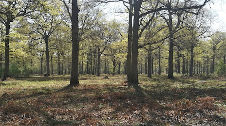
Forêt de Sénart on the map, Juvisy-sur-Orge, France
Photo
Where is located Forêt de Sénart
Forêt de Sénart — local attraction, which is located at France and belongs to the category — national forest. Average visitor rating for this place — 4.4 (according to 3434 ratings, information from open sources and relevant for 2022).
Exact location — Forêt de Sénart, marked on the map with a red marker.
You can get directions to Forêt de Sénart on the map from your location.
What else is interesting in Juvisy-sur-Orge? You can see all the sights if you go to the city page.
Coordinates
Forêt de Sénart, France coordinates in decimal format: latitude — 48.73371003763221, longitude — 2.4062934508173655. When converted to degrees, minutes, seconds Forêt de Sénart has the following coordinates: 48°44′1.36 north latitude and 2°24′22.66 east longitude.
Nearby cities
The largest cities that are located nearby:
- Boulogne-Billancourt — 19 km
- Orléans — 94 km
- Rouen — 124 km
- Amiens — 133 km
- Reims — 135 km
- Le Mans — 178 km
- Le Havre — 185 km
- Tours — 191 km
- Caen — 206 km
- Lille — 220 km
- Charleroi
 (Belgium) — 240 km
 - Dijon — 251 km
- Angers — 257 km
- Namur (Belgium) — 264 km
- Eastbourne
 (United Kingdom) — 272 km
 - Brussels (Belgium) — 276 km
- Nancy — 278 km
- Metz — 279 km
- Rennes — 306 km
Distance to the capital
Distance to the capital (Paris) is about — 14 km.