
 Gilserberg
Berlin
Bordesholm
Bechtolsheim
Aub
Triptis
Heppenheim
Biblis
Angermünde
Gilserberg
Berlin
Bordesholm
Bechtolsheim
Aub
Triptis
Heppenheim
Biblis
Angermünde
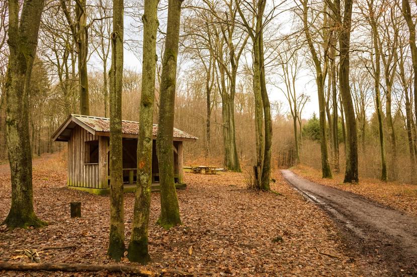
Waldschutzgebiet Steinbachtal/Netzbachtal on the map, Friedrichsthal, Germany
Photo
Where is located Waldschutzgebiet Steinbachtal/Netzbachtal
Waldschutzgebiet Steinbachtal/Netzbachtal — local attraction, which is located at Germany and belongs to the category — nature preserve. Average visitor rating for this place — 4.6 (according to 596 ratings, information from open sources and relevant for 2022).
Exact location — Waldschutzgebiet Steinbachtal/Netzbachtal, marked on the map with a red marker.
You can get directions to Waldschutzgebiet Steinbachtal/Netzbachtal on the map from your location.
What else is interesting in Friedrichsthal? You can see all the sights if you go to the city page.
Coordinates
Waldschutzgebiet Steinbachtal/Netzbachtal, Germany coordinates in decimal format: latitude — 49.299360997608304, longitude — 6.983102925144892. When converted to degrees, minutes, seconds Waldschutzgebiet Steinbachtal/Netzbachtal has the following coordinates: 49°17′57.7 north latitude and 6°58′59.17 east longitude.
Nearby cities
The largest cities that are located nearby:
- Saarbrücken — 12 km
- Trier — 57 km
- Metz
 (France) — 70 km
 - Strasbourg (France) — 96 km
- Nancy (France) — 97 km
- Ludwigshafen — 98 km
- Mannheim — 100 km
- Karlsruhe — 101 km
- Mainz — 110 km
- Heidelberg — 114 km
- Wiesbaden — 116 km
- Koblenz — 119 km
- Pforzheim — 126 km
- Darmstadt — 126 km
- Frankfurt — 142 km
- Offenbach — 146 km
- Heilbronn — 154 km
- Bonn — 156 km
- Freiburg — 157 km
Distance to the capital
Distance to the capital (Berlin) is about — 575 km.