
 Maureville
Samoëns
Gréning
Toulouse
Volx
Goudet
Méhoncourt
Saint-Hymer
Pontcarré
Maureville
Samoëns
Gréning
Toulouse
Volx
Goudet
Méhoncourt
Saint-Hymer
Pontcarré
Musée du plâtre on the map, Montigny-lès-Cormeilles, France
Photo
Where is located Musée du plâtre
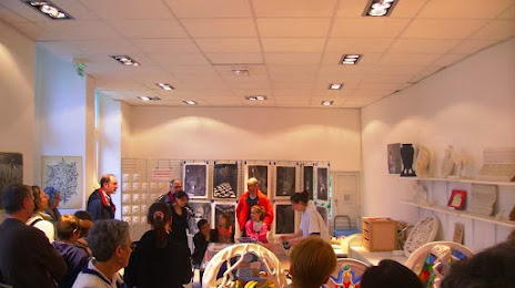
Musée du plâtre — local attraction, which is located at 31 Rue Thibault Chabrand, 95240 Cormeilles-en-Parisis, France and belongs to the category — museum. Average visitor rating for this place — 4.3 (according to 16 ratings, information from open sources and relevant for 2022).
Exact location — Musée du plâtre, marked on the map with a red marker.
You can get directions to Musée du plâtre on the map from your location.
What else is interesting in Montigny-lès-Cormeilles? You can see all the sights if you go to the city page.
Coordinates
Musée du plâtre, France coordinates in decimal format: latitude — 48.97634336885053, longitude — 2.198728125133403. When converted to degrees, minutes, seconds Musée du plâtre has the following coordinates: 48°58′34.84 north latitude and 2°11′55.42 east longitude.
Nearby cities
The largest cities that are located nearby:
- Boulogne-Billancourt — 17 km
- Rouen — 93 km
- Amiens — 101 km
- Orléans — 122 km
- Reims — 136 km
- Le Havre — 160 km
- Le Mans — 183 km
- Caen — 186 km
- Lille — 191 km
- Tours — 209 km
- Charleroi
 (Belgium) — 224 km
 - Eastbourne
 (United Kingdom) — 237 km
 - Namur (Belgium) — 250 km
- Brussels (Belgium) — 255 km
- Angers — 265 km
- Dijon — 282 km
- Crawley (United Kingdom) — 287 km
- Gillingham (United Kingdom) — 288 km
- Metz — 289 km
Distance to the capital
Distance to the capital (Paris) is about — 17 km.