
 Maureville
Samoëns
Gréning
Toulouse
Volx
Goudet
Méhoncourt
Saint-Hymer
Pontcarré
Maureville
Samoëns
Gréning
Toulouse
Volx
Goudet
Méhoncourt
Saint-Hymer
Pontcarré
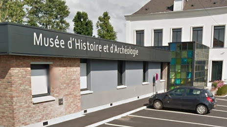
Musée d'Histoire et d'Archéologie - Harnes on the map, Montigny-en-Gohelle, France
Photo
Where is located Musée d'Histoire et d'Archéologie - Harnes
Musée d'Histoire et d'Archéologie - Harnes — local attraction, which is located at Rue de Picardie, 62440 Harnes, France and belongs to the category — museum. Average visitor rating for this place — 4.5 (according to 2 ratings, information from open sources and relevant for 2022).
Exact location — Musée d'Histoire et d'Archéologie - Harnes, marked on the map with a red marker.
You can get directions to Musée d'Histoire et d'Archéologie - Harnes on the map from your location.
What else is interesting in Montigny-en-Gohelle? You can see all the sights if you go to the city page.
Coordinates
Musée d'Histoire et d'Archéologie - Harnes, France coordinates in decimal format: latitude — 50.4477892198879, longitude — 2.910248325186146. When converted to degrees, minutes, seconds Musée d'Histoire et d'Archéologie - Harnes has the following coordinates: 50°26′52.04 north latitude and 2°54′36.89 east longitude.
Nearby cities
The largest cities that are located nearby:
- Lille — 24 km
- Amiens — 74 km
- Charleroi
 (Belgium) — 107 km
 - Brussels (Belgium) — 110 km
- Antwerp (Belgium) — 135 km
- Namur (Belgium) — 137 km
- Reims — 152 km
- Rouen — 171 km
- Breda
 (Netherlands) — 180 km
 - Boulogne-Billancourt — 183 km
- Liège (Belgium) — 187 km
- Eastbourne
 (United Kingdom) — 188 km
 - Tilburg (Netherlands) — 194 km
- Dordrecht (Netherlands) — 195 km
- Gillingham (United Kingdom) — 195 km
- Rotterdam (Netherlands) — 196 km
- Southend-on-Sea (United Kingdom) — 196 km
- Maastricht (Netherlands) — 199 km
- The Hague (Netherlands) — 204 km
Distance to the capital
Distance to the capital (Paris) is about — 181 km.