
 Maureville
Samoëns
Gréning
Toulouse
Volx
Goudet
Méhoncourt
Saint-Hymer
Pontcarré
Maureville
Samoëns
Gréning
Toulouse
Volx
Goudet
Méhoncourt
Saint-Hymer
Pontcarré
Parc Stalingrad on the map, Romainville, France
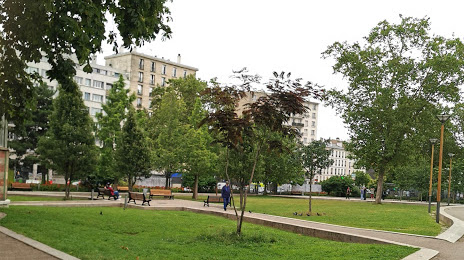
Photo
Where is located Parc Stalingrad
Parc Stalingrad — local attraction, which is located at 102 Av. Jean Lolive, 93500 Pantin, France and belongs to the category — city park. Average visitor rating for this place — 4.1 (according to 419 ratings, information from open sources and relevant for 2022).
Exact location — Parc Stalingrad, marked on the map with a red marker.
You can get directions to Parc Stalingrad on the map from your location.
What else is interesting in Romainville? You can see all the sights if you go to the city page.
Coordinates
Parc Stalingrad, France coordinates in decimal format: latitude — 48.87157965836772, longitude — 2.40490557176966. When converted to degrees, minutes, seconds Parc Stalingrad has the following coordinates: 48°52′17.69 north latitude and 2°24′17.66 east longitude.
Nearby cities
The largest cities that are located nearby:
- Boulogne-Billancourt — 15 km
- Amiens — 112 km
- Rouen — 114 km
- Orléans — 115 km
- Reims — 122 km
- Le Havre — 180 km
- Le Mans — 192 km
- Lille — 198 km
- Caen — 205 km
- Tours — 211 km
- Charleroi
 (Belgium) — 220 km
 - Namur (Belgium) — 245 km
- Brussels (Belgium) — 255 km
- Eastbourne
 (United Kingdom) — 256 km
 - Dijon — 261 km
- Metz — 272 km
- Angers — 273 km
- Nancy — 274 km
- Antwerp (Belgium) — 292 km
Distance to the capital
Distance to the capital (Paris) is about — 4 km.