
 Bel-Ha
San Jose El Alto
El Porvenir
Nueva Palestina
Santa Lucía
Chemax
La Morita
Temoac
Zacualpan
Bel-Ha
San Jose El Alto
El Porvenir
Nueva Palestina
Santa Lucía
Chemax
La Morita
Temoac
Zacualpan
La Selvita on the map, Tototlan, Mexico
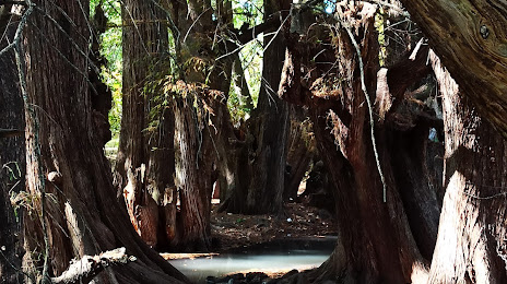
Photo
Where is located La Selvita
La Selvita — local attraction, which is located at Domicilio Conocido S/N La Isla, 47734 Tototlán, Jal., Mexico and belongs to the category — park. Average visitor rating for this place — 4.6 (according to 221 rating, information from open sources and relevant for 2022).
Exact location — La Selvita, marked on the map with a red marker.
You can get directions to La Selvita on the map from your location.
What else is interesting in Tototlan? You can see all the sights if you go to the city page.
Coordinates
La Selvita, Mexico coordinates in decimal format: latitude — 20.596140470825777, longitude — -102.74663057561975. When converted to degrees, minutes, seconds La Selvita has the following coordinates: 20°35′46.11 north latitude and -102°44′47.87 east longitude.
Nearby cities
The largest cities that are located nearby:
- Tonalá — 48 km
- Tlaquepaque — 55 km
- Guadalajara — 59 km
- Zapopan — 67 km
- Zamora — 81 km
- León — 131 km
- Uruapan — 148 km
- Irapuato — 149 km
- Aguascalientes — 157 km
- Salamanca — 164 km
- Colima — 174 km
- Morelia — 190 km
- Celaya — 205 km
- Manzanillo — 226 km
- Tepic — 241 km
- Zacatecas — 247 km
- Santiago de Querétaro — 248 km
- Puerto Vallarta — 252 km
- San Luis Potosi — 257 km
Distance to the capital
Distance to the capital (Mexico City) is about — 399 km.