
 Varlosen
Differten
Steiningen
Neugablonz
Schwäbisch Gmünd
Wobbenbüll
Ehrenfeld
Klein Trebbow
Poppau
Sacka
Dramfeld
Trebendorf
Mertesheim
Idelberg
Beierfeld
Norderwöhrden
Kleinburgwedel
Kleinschwabhausen
Brelingen
Varlosen
Differten
Steiningen
Neugablonz
Schwäbisch Gmünd
Wobbenbüll
Ehrenfeld
Klein Trebbow
Poppau
Sacka
Dramfeld
Trebendorf
Mertesheim
Idelberg
Beierfeld
Norderwöhrden
Kleinburgwedel
Kleinschwabhausen
Brelingen
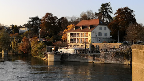
Rheinfelden on the map, Germany
Where is located Rheinfelden
Exact location — Rheinfelden, Freiburg, Baden-Württemberg, Germany, marked on the map with a red marker.
Coordinates
Rheinfelden, Germany coordinates in decimal format: latitude — 47.561111, longitude — 7.791667. When converted to degrees, minutes, seconds Rheinfelden has the following coordinates: 47°33′40 north latitude and 7°47′30 east longitude.
Population
Rheinfelden, Freiburg, Baden-Württemberg, Germany, according to our data the population is — 10,733 residents, which is about 0% of the total population of the country (Germany).
Comparison of the population on the graph:
Exact time
Time zone for this location Rheinfelden — UTC +2 Europe/Berlin. Exact time — sunday, 5 may 2024 year, 04 h. 54 minutes.
Sunrise and sunset
Rheinfelden, sunrise and sunset data for a date — sunday 26.05.2024.
| Sunrise | Sunset | Day (duration) |
|---|---|---|
| 05:43 -1 minute | 21:08 +1 minute | 15 h. 24 minutes. +2 minutes |
You can control the scale of the map using the auxiliary tools to find out exactly where it is located Rheinfelden. When you change the scale of the map, the width of the ruler also changes (in kilometers and miles).
Nearby cities
The largest cities that are located nearby:
- Basel
 (Switzerland) — 14 km
 - Mulhouse
 (France) — 40 km
 - Freiburg — 49 km
- Zurich (Switzerland) — 60 km
- Bern (Switzerland) — 73 km
- Strasbourg (France) — 112 km
- Besançon (France) — 137 km
- Lausanne (Switzerland) — 145 km
- Reutlingen — 147 km
- Pforzheim — 161 km
- Karlsruhe — 166 km
- Stuttgart — 168 km
- Nancy (France) — 171 km
- Ulm — 186 km
- Saarbrücken — 194 km
- Geneva (Switzerland) — 197 km
- Heilbronn — 203 km
- Dijon (France) — 208 km
- Metz (France) — 208 km
Distance to neighboring capitals:
- Bern (Switzerland) — 73 km
- Vaduz
 (Liechtenstein) — 138 km
 - Paris (France) — 428 km
- Paris (France) — 428 km
- Brussels
 (Belgium) — 443 km
 - Ljubljana
 (Slovenia) — 538 km
 - Prague
 (Czech Republic) — 561 km
 - Amsterdam
 (Netherlands) — 574 km
 - Vienna
 (Austria) — 644 km
 - Rome
 (Italy) — 731 km
 - Copenhagen
 (Denmark) — 960 km
 - Warsaw
 (Poland) — 1078 km
 - Oslo
 (Norway) — 1387 km
 - Stockholm
 (Sweden) — 1466 km
 - Minsk
 (Belarus) — 1553 km
 - Kyiv
 (Ukraine) — 1682 km
 - Helsinki
 (Finland) — 1787 km
Attractions

Distance to the capital
Distance to the capital (Berlin) is about — 681 km.