
 Puerto de la Duquesa
La Serna de Iguña
Pumalverde
Puentenansa
La Iglesia
Casar de Periedo
Fuengirola
Renedo de Piélagos
Villabanez
Puerto de la Duquesa
La Serna de Iguña
Pumalverde
Puentenansa
La Iglesia
Casar de Periedo
Fuengirola
Renedo de Piélagos
Villabanez
Port of Maó-Mahón on the map, Mahón, Spain
Photo
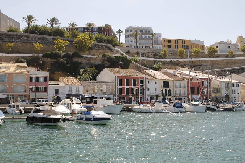
Where is located Port of Maó-Mahón
Port of Maó-Mahón — local attraction, which is located at no data and belongs to the category — -. Average visitor rating for this place — 4.5 (according to 159 ratings, information from open sources and relevant for 2022).
Exact location — Port of Maó-Mahón, marked on the map with a red marker.
You can get directions to Port of Maó-Mahón on the map from your location.
What else is interesting in Mahón? You can see all the sights if you go to the city page.
Coordinates
Port of Maó-Mahón, Spain coordinates in decimal format: latitude — 39.89093300915411, longitude — 4.2627667831575655. When converted to degrees, minutes, seconds Port of Maó-Mahón has the following coordinates: 39°53′27.36 north latitude and 4°15′45.96 east longitude.
Nearby cities
The largest cities that are located nearby:
- Palma — 141 km
- Mataró — 236 km
- Badalona — 240 km
- L'Hospitalet de Llobregat — 241 km
- Santa Coloma de Gramenet — 241 km
- Sabadell — 255 km
- Terrassa — 262 km
- Tarragona — 285 km
- Perpignan
 (France) — 329 km
 - Bejaia
 (Algeria) — 354 km
 - Lleida — 356 km
- Sidi M'Hamed (Algeria) — 362 km
- Sassari
 (Italy) — 372 km
 - Toulon (France) — 382 km
- Marseille (France) — 387 km
- Valencia — 398 km
- Skikda (Algeria) — 408 km
- Montpellier (France) — 412 km
- Aix-en-Provence (France) — 414 km
Distance to the capital
Distance to the capital (Madrid) is about — 680 km.