
 Gilserberg
Berlin
Bordesholm
Bechtolsheim
Aub
Triptis
Heppenheim
Biblis
Angermünde
Gilserberg
Berlin
Bordesholm
Bechtolsheim
Aub
Triptis
Heppenheim
Biblis
Angermünde
Abt. Feuerwehr- und Technikmuseum on the map, Eisenhüttenstadt, Germany
Photo
Where is located Abt. Feuerwehr- und Technikmuseum
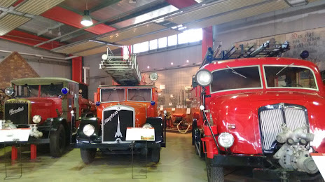
Abt. Feuerwehr- und Technikmuseum — local attraction, which is located at Heinrich-Pritzsche-Straße 26, 15890 Eisenhüttenstadt, Germany and belongs to the category — technology museum. Average visitor rating for this place — 4.6 (according to 29 ratings, information from open sources and relevant for 2022).
Exact location — Abt. Feuerwehr- und Technikmuseum, marked on the map with a red marker.
You can get directions to Abt. Feuerwehr- und Technikmuseum on the map from your location.
What else is interesting in Eisenhüttenstadt? You can see all the sights if you go to the city page.
Coordinates
Abt. Feuerwehr- und Technikmuseum, Germany coordinates in decimal format: latitude — 52.14455035184307, longitude — 14.665585525342982. When converted to degrees, minutes, seconds Abt. Feuerwehr- und Technikmuseum has the following coordinates: 52°8′40.38 north latitude and 14°39′56.11 east longitude.
Nearby cities
The largest cities that are located nearby:
- Cottbus — 48 km
- Zielona Gora
 (Poland) — 63 km
 - Gorzów Wielkopolski (Poland) — 76 km
- Berlin — 93 km
- Potsdam — 110 km
- Dresden — 136 km
- Szczecin (Poland) — 142 km
- Legnica (Poland) — 147 km
- Poznań (Poland) — 157 km
- Leipzig — 180 km
- Chemnitz — 189 km
- Walbrzych (Poland) — 189 km
- Wrocław (Poland) — 202 km
- Magdeburg — 205 km
- Gera — 226 km
- Prague
 (Czech Republic) — 229 km
 - Kalisz (Poland) — 239 km
- Koszalin (Poland) — 247 km
- Bydgoszcz (Poland) — 248 km
Distance to the capital
Distance to the capital (Berlin) is about — 95 km.