
 Józefów nad Wisłą
Gorzyce Wielkie
Rogówek
Sromowce Niżne
Wyszków County
Kruszewo
Jantar
Sady Górne
Nagoszewo
Józefów nad Wisłą
Gorzyce Wielkie
Rogówek
Sromowce Niżne
Wyszków County
Kruszewo
Jantar
Sady Górne
Nagoszewo
Las Kumiecie on the map, Gołdap, Poland
Photo
Where is located Las Kumiecie
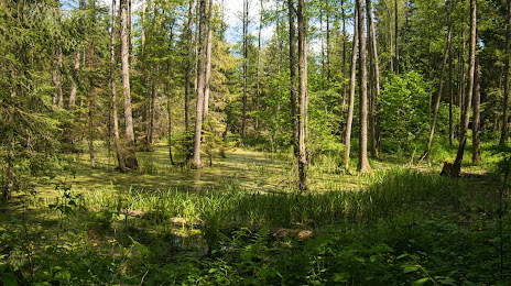
Las Kumiecie — local attraction, which is located at Świerkowa 43, 19-500 Gołdap, Poland and belongs to the category — national forest. Average visitor rating for this place — 4.7 (according to 136 ratings, information from open sources and relevant for 2022).
Exact location — Las Kumiecie, marked on the map with a red marker.
You can get directions to Las Kumiecie on the map from your location.
What else is interesting in Gołdap? You can see all the sights if you go to the city page.
Coordinates
Las Kumiecie, Poland coordinates in decimal format: latitude — 54.323308822927075, longitude — 22.313571425424968. When converted to degrees, minutes, seconds Las Kumiecie has the following coordinates: 54°19′23.91 north latitude and 22°18′48.86 east longitude.
Nearby cities
The largest cities that are located nearby:
- Kaunas
 (Lithuania) — 121 km
 - Kaliningrad
 (Russia) — 123 km
 - Olsztyn — 133 km
- Bialystok — 142 km
- Klaipėda (Lithuania) — 170 km
- Elblag — 188 km
- Šiauliai (Lithuania) — 191 km
- Vilnius (Lithuania) — 195 km
- Panevėžys (Lithuania) — 203 km
- Gdańsk — 236 km
- Gdynia — 243 km
- Plock — 261 km
- Brest
 (Belarus) — 263 km
 - Baranovichi (Belarus) — 278 km
- Wloclawek — 284 km
- Torun — 285 km
- Maladzyechna (Belarus) — 293 km
- Rīga
 (Latvia) — 312 km
 - Bydgoszcz — 314 km
Distance to the capital
Distance to the capital (Warsaw) is about — 248 km.