
 Gilserberg
Berlin
Bordesholm
Bechtolsheim
Aub
Triptis
Heppenheim
Biblis
Angermünde
Gilserberg
Berlin
Bordesholm
Bechtolsheim
Aub
Triptis
Heppenheim
Biblis
Angermünde
Skigebiet Olpe-Fahlenscheid on the map, Kirchhundem, Germany
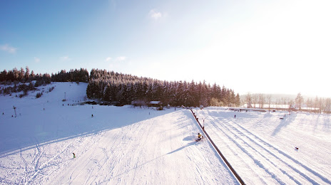
Photo
Where is located Skigebiet Olpe-Fahlenscheid
Skigebiet Olpe-Fahlenscheid — local attraction, which is located at K18, 57462 Olpe-Fahlenscheid, Germany and belongs to the category — ski resort. Average visitor rating for this place — 4.4 (according to 390 ratings, information from open sources and relevant for 2022).
Exact location — Skigebiet Olpe-Fahlenscheid, marked on the map with a red marker.
You can get directions to Skigebiet Olpe-Fahlenscheid on the map from your location.
What else is interesting in Kirchhundem? You can see all the sights if you go to the city page.
Coordinates
Skigebiet Olpe-Fahlenscheid, Germany coordinates in decimal format: latitude — 51.0570876335345, longitude — 7.951306625302886. When converted to degrees, minutes, seconds Skigebiet Olpe-Fahlenscheid has the following coordinates: 51°3′25.52 north latitude and 7°57′4.7 east longitude.
Nearby cities
The largest cities that are located nearby:
- Siegen — 23 km
- Hagen — 53 km
- Remscheid — 63 km
- Dortmund — 64 km
- Witten — 65 km
- Bergisch Gladbach — 68 km
- Wuppertal — 68 km
- Hamm — 68 km
- Solingen — 70 km
- Bochum — 75 km
- Herne — 79 km
- Bonn — 79 km
- Cologne — 80 km
- Paderborn — 84 km
- Gelsenkirchen — 84 km
- Recklinghausen — 85 km
- Essen — 85 km
- Koblenz — 88 km
- Mülheim — 91 km
Distance to the capital
Distance to the capital (Berlin) is about — 409 km.