
 Puerto de la Duquesa
La Serna de Iguña
Pumalverde
Puentenansa
La Iglesia
Casar de Periedo
Fuengirola
Renedo de Piélagos
Villabanez
Puerto de la Duquesa
La Serna de Iguña
Pumalverde
Puentenansa
La Iglesia
Casar de Periedo
Fuengirola
Renedo de Piélagos
Villabanez
Platja del Carrer de la Mar on the map, El Campello, Spain
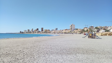
Photo
Where is located Platja del Carrer de la Mar
Platja del Carrer de la Mar — local attraction, which is located at no data and belongs to the category — -. Average visitor rating for this place — 4.6 (according to 31 rating, information from open sources and relevant for 2022).
Exact location — Platja del Carrer de la Mar, marked on the map with a red marker.
You can get directions to Platja del Carrer de la Mar on the map from your location.
What else is interesting in El Campello? You can see all the sights if you go to the city page.
Coordinates
Platja del Carrer de la Mar, Spain coordinates in decimal format: latitude — 38.42726970739998, longitude — -0.3891246751140368. When converted to degrees, minutes, seconds Platja del Carrer de la Mar has the following coordinates: 38°25′38.17 north latitude and -0°23′20.85 east longitude.
Nearby cities
The largest cities that are located nearby:
- Murcia — 80 km
- Cartagena — 103 km
- Valencia — 115 km
- Albacete — 140 km
- Almería — 254 km
- Palma — 289 km
- Chlef
 (Algeria) — 294 km
 - Oran (Algeria) — 303 km
- Jaén — 305 km
- Relizane (Algeria) — 310 km
- Granada — 314 km
- Tarragona — 327 km
- Alcala de Henares — 337 km
- Torrejón de Ardoz — 342 km
- Getafe — 350 km
- Fuenlabrada — 353 km
- Leganés — 354 km
- Algiers (Algeria) — 357 km
- Sidi Bel Abbes (Algeria) — 358 km
Distance to the capital
Distance to the capital (Madrid) is about — 361 km.