
 Puerto de la Duquesa
La Serna de Iguña
Pumalverde
Puentenansa
La Iglesia
Casar de Periedo
Fuengirola
Renedo de Piélagos
Villabanez
Puerto de la Duquesa
La Serna de Iguña
Pumalverde
Puentenansa
La Iglesia
Casar de Periedo
Fuengirola
Renedo de Piélagos
Villabanez
Playa la Torre on the map, Almassora, Spain
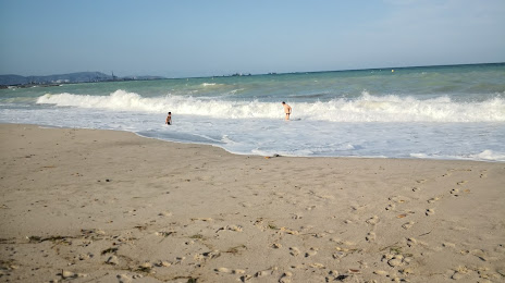
Photo
Where is located Playa la Torre
Playa la Torre — local attraction, which is located at no data and belongs to the category — -. Average visitor rating for this place — 4.5 (according to 37 ratings, information from open sources and relevant for 2022).
Exact location — Playa la Torre, marked on the map with a red marker.
You can get directions to Playa la Torre on the map from your location.
What else is interesting in Almassora? You can see all the sights if you go to the city page.
Coordinates
Playa la Torre, Spain coordinates in decimal format: latitude — 39.92121196264051, longitude — -0.0040500750280749705. When converted to degrees, minutes, seconds Playa la Torre has the following coordinates: 39°55′16.36 north latitude and -0°0′14.58 east longitude.
Nearby cities
The largest cities that are located nearby:
- Valencia — 59 km
- Tarragona — 169 km
- Albacete — 187 km
- Lleida — 193 km
- Zaragoza — 200 km
- Palma — 235 km
- Murcia — 235 km
- L'Hospitalet de Llobregat — 239 km
- Terrassa — 248 km
- Santa Coloma de Gramenet — 251 km
- Sabadell — 252 km
- Badalona — 253 km
- Cartagena — 269 km
- Mataró — 272 km
- Alcala de Henares — 284 km
- Torrejón de Ardoz — 293 km
- Alcobendas — 307 km
- Getafe — 312 km
- Leganés — 315 km
Distance to the capital
Distance to the capital (Madrid) is about — 319 km.