
 Puerto de la Duquesa
La Serna de Iguña
Pumalverde
Puentenansa
La Iglesia
Casar de Periedo
Fuengirola
Renedo de Piélagos
Villabanez
Puerto de la Duquesa
La Serna de Iguña
Pumalverde
Puentenansa
La Iglesia
Casar de Periedo
Fuengirola
Renedo de Piélagos
Villabanez
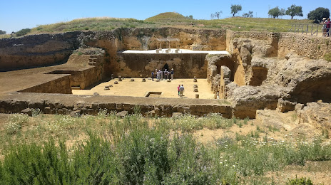
Tumba de Servilia on the map, Carmona, Spain
Photo
Where is located Tumba de Servilia
Tumba de Servilia — local attraction, which is located at 41410 Carmona, Seville, Spain and belongs to the category — historical landmark. Average visitor rating for this place — 4.6 (according to 37 ratings, information from open sources and relevant for 2022).
Exact location — Tumba de Servilia, marked on the map with a red marker.
You can get directions to Tumba de Servilia on the map from your location.
What else is interesting in Carmona? You can see all the sights if you go to the city page.
Coordinates
Tumba de Servilia, Spain coordinates in decimal format: latitude — 37.467320460159215, longitude — -5.652319675141748. When converted to degrees, minutes, seconds Tumba de Servilia has the following coordinates: 37°28′2.35 north latitude and -5°39′8.35 east longitude.
Nearby cities
The largest cities that are located nearby:
- Dos Hermanas — 32 km
- Córdoba — 88 km
- Jerez — 97 km
- Huelva — 117 km
- Cádiz — 119 km
- Marbella — 126 km
- Málaga — 135 km
- Algeciras — 148 km
- Jaén — 166 km
- Granada — 183 km
- Tangier
 (Morocco) — 190 km
 - Badajoz — 193 km
- Tetouan (Morocco) — 212 km
- Almería — 290 km
- Lisbon
 (Portugal) — 332 km
 - Taounate (Morocco) — 337 km
- Amadora (Portugal) — 340 km
- Queluz (Portugal) — 343 km
- Fuenlabrada — 348 km
Distance to the capital
Distance to the capital (Madrid) is about — 369 km.