
 Puerto de la Duquesa
La Serna de Iguña
Pumalverde
Puentenansa
La Iglesia
Casar de Periedo
Fuengirola
Renedo de Piélagos
Villabanez
Puerto de la Duquesa
La Serna de Iguña
Pumalverde
Puentenansa
La Iglesia
Casar de Periedo
Fuengirola
Renedo de Piélagos
Villabanez
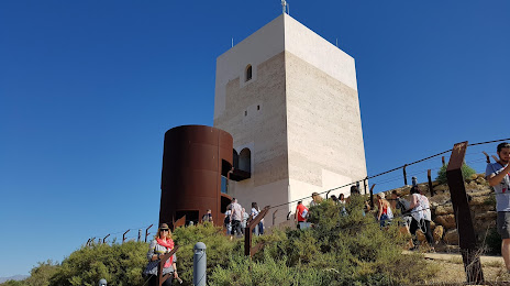
Castillo De Huércal Overa on the map, Huércal-Overa, Spain
Photo
Where is located Castillo De Huércal Overa
Castillo De Huércal Overa — local attraction, which is located at 04600 Huércal-Overa, Almería, Spain and belongs to the category — castle. Average visitor rating for this place — 4.1 (according to 28 ratings, information from open sources and relevant for 2022).
Exact location — Castillo De Huércal Overa, marked on the map with a red marker.
You can get directions to Castillo De Huércal Overa on the map from your location.
What else is interesting in Huércal-Overa? You can see all the sights if you go to the city page.
Coordinates
Castillo De Huércal Overa, Spain coordinates in decimal format: latitude — 37.397053764476404, longitude — -1.9424174707999844. When converted to degrees, minutes, seconds Castillo De Huércal Overa has the following coordinates: 37°23′49.39 north latitude and -1°56′32.7 east longitude.
Nearby cities
The largest cities that are located nearby:
- Almería — 77 km
- Cartagena — 87 km
- Murcia — 97 km
- Granada — 148 km
- Jaén — 167 km
- Albacete — 177 km
- Oran
 (Algeria) — 221 km
 - Málaga — 232 km
- Córdoba — 254 km
- Nador
 (Morocco) — 262 km
 - Valencia — 265 km
- Sidi Bel Abbes (Algeria) — 270 km
- Marbella — 279 km
- Tlemcen (Algeria) — 284 km
- Relizane (Algeria) — 289 km
- Oujda (Morocco) — 300 km
- Chlef (Algeria) — 322 km
- Saida (Algeria) — 340 km
- Algeciras — 343 km
Distance to the capital
Distance to the capital (Madrid) is about — 369 km.