
 Zhumadian
Ningbo Lishe International Airport
Jiangxi
Xiangfu
Dongguan
Yunnan
Ürümqi Diwopu International Airport
Gansu
Deyang
Zhumadian
Ningbo Lishe International Airport
Jiangxi
Xiangfu
Dongguan
Yunnan
Ürümqi Diwopu International Airport
Gansu
Deyang
Taohuayuan National Forest Park on the map, Changde, China
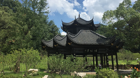
Photo
Where is located Taohuayuan National Forest Park
Taohuayuan National Forest Park — local attraction, which is located at China, Hunan, Changde, Taoyuan County, 319 Guo Dao, 桃花源镇 and belongs to the category — park. Average visitor rating for this place — 5.0 (according to 1 rating, information from open sources and relevant for 2022).
Exact location — Taohuayuan National Forest Park, marked on the map with a red marker.
You can get directions to Taohuayuan National Forest Park on the map from your location.
What else is interesting in Changde? You can see all the sights if you go to the city page.
Coordinates
Taohuayuan National Forest Park, China coordinates in decimal format: latitude — 28.745590499046063, longitude — 111.48553014317913. When converted to degrees, minutes, seconds Taohuayuan National Forest Park has the following coordinates: 28°44′44.13 north latitude and 111°29′7.91 east longitude.
Nearby cities
The largest cities that are located nearby:
- Yiyang — 83 km
- Yueyang — 143 km
- Changsha — 150 km
- Loudi — 150 km
- Jingzhou — 153 km
- Yichang — 188 km
- Zhuzhou — 193 km
- Shaoyang — 200 km
- Jingmen — 227 km
- Pingxiang — 262 km
- Xianning — 267 km
- Xiaogan — 297 km
- Wuhan — 302 km
- Xiangyang — 332 km
- Suizhou — 334 km
- Ezhou — 340 km
- Huangshi — 344 km
- Chenzhou — 384 km
- Ji'an — 387 km
Distance to the capital
Distance to the capital (Beijing) is about — 1320 km.