
 Zhumadian
Ningbo Lishe International Airport
Jiangxi
Xiangfu
Dongguan
Yunnan
Ürümqi Diwopu International Airport
Gansu
Deyang
Zhumadian
Ningbo Lishe International Airport
Jiangxi
Xiangfu
Dongguan
Yunnan
Ürümqi Diwopu International Airport
Gansu
Deyang
丹噶尔古城 on the map, Xining, China
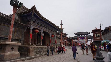
Photo
Where is located 丹噶尔古城
丹噶尔古城 — local attraction, which is located at Huangyuan County, Xining, Qinghai, China and belongs to the category — -. Average visitor rating for this place — 3.5 (according to 2 ratings, information from open sources and relevant for 2022).
Exact location — 丹噶尔古城, marked on the map with a red marker.
You can get directions to 丹噶尔古城 on the map from your location.
What else is interesting in Xining? You can see all the sights if you go to the city page.
Coordinates
丹噶尔古城, China coordinates in decimal format: latitude — 36.6771426608136, longitude — 101.24818897972548. When converted to degrees, minutes, seconds 丹噶尔古城 has the following coordinates: 36°40′37.71 north latitude and 101°14′53.48 east longitude.
Nearby cities
The largest cities that are located nearby:
- Wuwei — 163 km
- Linxia — 171 km
- Lanzhou — 194 km
- Baiyin — 210 km
- Tianshui — 424 km
- Yinchuan — 437 km
- Jiayuguan — 458 km
- Wuhai — 543 km
- Baoji — 557 km
- Guangyuan — 598 km
- Hanzhong — 625 km
- Mianyang — 632 km
- Deyang — 656 km
- Xianyang — 681 km
- Xi'an — 701 km
- Chengdu — 703 km
- Weinan — 742 km
- Ordos — 758 km
- Nanchong — 760 km
Distance to the capital
Distance to the capital (Beijing) is about — 1369 km.