
 Pithoro
Kandhra
Sultan Kot
Rahimabad
Mithiani
New Jatoi
Ratanabad
Bhaledino Kaka
Arija
Pithoro
Kandhra
Sultan Kot
Rahimabad
Mithiani
New Jatoi
Ratanabad
Bhaledino Kaka
Arija
Army Museum on the map, Rawalpindi, Pakistan
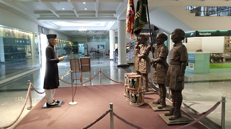
Photo
Where is located Army Museum
Army Museum — local attraction, which is located at Iftikhar Janjua Road, Rawalpindi, Punjab 46000, Pakistan and belongs to the category — museum. Average visitor rating for this place — 4.8 (according to 1366 ratings, information from open sources and relevant for 2022).
Exact location — Army Museum, marked on the map with a red marker.
You can get directions to Army Museum on the map from your location.
What else is interesting in Rawalpindi? You can see all the sights if you go to the city page.
Coordinates
Army Museum, Pakistan coordinates in decimal format: latitude — 33.58664476127926, longitude — 73.0541035247523. When converted to degrees, minutes, seconds Army Museum has the following coordinates: 33°35′11.92 north latitude and 73°3′14.77 east longitude.
Nearby cities
The largest cities that are located nearby:
- Wah — 36 km
- Abbottābad — 65 km
- Chakwal — 76 km
- Kotli
 — 79 km
 - Jhelum — 97 km
- Mardan — 113 km
- Mandi Bahauddin — 119 km
- Peshawar — 142 km
- Mingora — 144 km
- Kohat — 148 km
- Khushāb — 157 km
- Wazirabad — 163 km
- Srinagar
 — 169 km
 - Sargodha — 171 km
- Hafizabad — 179 km
- Siālkot — 185 km
- Daska — 186 km
- Gujranwala — 192 km
- Jammu — 194 km
Distance to the capital
Distance to the capital (Islamabad) is about — 16 km.