
 Maureville
Samoëns
Gréning
Toulouse
Volx
Goudet
Méhoncourt
Saint-Hymer
Pontcarré
Maureville
Samoëns
Gréning
Toulouse
Volx
Goudet
Méhoncourt
Saint-Hymer
Pontcarré
Museo de Cera on the map, Lourdes, France
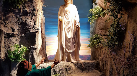
Photo
Where is located Museo de Cera
Museo de Cera — local attraction, which is located at 87 Rue de la Grotte, 65100 Lourdes, France and belongs to the category — wax museum. Average visitor rating for this place — 4.4 (according to 469 ratings, information from open sources and relevant for 2022).
Exact location — Museo de Cera, marked on the map with a red marker.
You can get directions to Museo de Cera on the map from your location.
What else is interesting in Lourdes? You can see all the sights if you go to the city page.
Coordinates
Museo de Cera, France coordinates in decimal format: latitude — 43.0955139245114, longitude — -0.05124607497082022. When converted to degrees, minutes, seconds Museo de Cera has the following coordinates: 43°5′43.85 north latitude and -0°3′4.49 east longitude.
Nearby cities
The largest cities that are located nearby:
- Toulouse — 132 km
- Pamplona
 (Spain) — 133 km
 - San Sebastián (Spain) — 158 km
- Lleida (Spain) — 172 km
- Zaragoza (Spain) — 174 km
- Bordeaux — 198 km
- Logroño (Spain) — 208 km
- Vitoria-Gasteiz (Spain) — 215 km
- Bilbao (Spain) — 233 km
- Terrassa (Spain) — 240 km
- Perpignan — 243 km
- Tarragona (Spain) — 243 km
- Sabadell (Spain) — 247 km
- Santa Coloma de Gramenet (Spain) — 261 km
- L'Hospitalet de Llobregat (Spain) — 262 km
- Badalona (Spain) — 263 km
- Mataró (Spain) — 268 km
- Santander (Spain) — 305 km
- Burgos (Spain) — 310 km
Distance to the capital
Distance to the capital (Paris) is about — 667 km.