
 Maureville
Samoëns
Gréning
Toulouse
Volx
Goudet
Méhoncourt
Saint-Hymer
Pontcarré
Maureville
Samoëns
Gréning
Toulouse
Volx
Goudet
Méhoncourt
Saint-Hymer
Pontcarré
Diocese De Créteil on the map, Alfortville, France
Photo
Where is located Diocese De Créteil
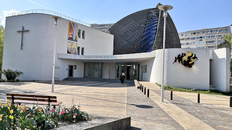
Diocese De Créteil — local attraction, which is located at 2 Rue Pasteur Vallery Radot 1er étage, 94000 Créteil, France and belongs to the category — cathedral. Average visitor rating for this place — 4.5 (according to 179 ratings, information from open sources and relevant for 2022).
Exact location — Diocese De Créteil, marked on the map with a red marker.
You can get directions to Diocese De Créteil on the map from your location.
What else is interesting in Alfortville? You can see all the sights if you go to the city page.
Coordinates
Diocese De Créteil, France coordinates in decimal format: latitude — 48.789617171338676, longitude — 2.444513325221373. When converted to degrees, minutes, seconds Diocese De Créteil has the following coordinates: 48°47′22.62 north latitude and 2°26′40.25 east longitude.
Nearby cities
The largest cities that are located nearby:
- Boulogne-Billancourt — 14 km
- Orléans — 106 km
- Rouen — 119 km
- Amiens — 121 km
- Reims — 127 km
- Le Havre — 183 km
- Le Mans — 186 km
- Tours — 203 km
- Caen — 206 km
- Lille — 207 km
- Charleroi
 (Belgium) — 228 km
 - Namur (Belgium) — 252 km
- Dijon — 255 km
- Brussels (Belgium) — 264 km
- Eastbourne
 (United Kingdom) — 264 km
 - Angers — 267 km
- Metz — 274 km
- Nancy — 275 km
- Liège (Belgium) — 300 km
Distance to the capital
Distance to the capital (Paris) is about — 10 km.