
 Maureville
Samoëns
Gréning
Toulouse
Volx
Goudet
Méhoncourt
Saint-Hymer
Pontcarré
Maureville
Samoëns
Gréning
Toulouse
Volx
Goudet
Méhoncourt
Saint-Hymer
Pontcarré
Laboratoire Recherche Monuments Historiques on the map, Noisiel, France
Photo
Where is located Laboratoire Recherche Monuments Historiques
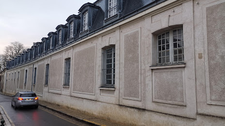
Laboratoire Recherche Monuments Historiques — local attraction, which is located at 29 Rue de Paris, 77420 Champs-sur-Marne, France and belongs to the category — museum. Average visitor rating for this place — 4.8 (according to 6 ratings, information from open sources and relevant for 2022).
Exact location — Laboratoire Recherche Monuments Historiques, marked on the map with a red marker.
You can get directions to Laboratoire Recherche Monuments Historiques on the map from your location.
What else is interesting in Noisiel? You can see all the sights if you go to the city page.
Coordinates
Laboratoire Recherche Monuments Historiques, France coordinates in decimal format: latitude — 48.8523873111547, longitude — 2.603522725223595. When converted to degrees, minutes, seconds Laboratoire Recherche Monuments Historiques has the following coordinates: 48°51′8.59 north latitude and 2°36′12.68 east longitude.
Nearby cities
The largest cities that are located nearby:
- Boulogne-Billancourt — 28 km
- Reims — 111 km
- Amiens — 117 km
- Orléans — 118 km
- Rouen — 128 km
- Le Havre — 194 km
- Lille — 198 km
- Le Mans — 203 km
- Charleroi
 (Belgium) — 214 km
 - Tours — 217 km
- Caen — 220 km
- Namur (Belgium) — 238 km
- Dijon — 248 km
- Brussels (Belgium) — 251 km
- Metz — 258 km
- Nancy — 260 km
- Eastbourne
 (United Kingdom) — 267 km
 - Angers — 283 km
- Liège (Belgium) — 285 km
Distance to the capital
Distance to the capital (Paris) is about — 18 km.