
 Maureville
Samoëns
Gréning
Toulouse
Volx
Goudet
Méhoncourt
Saint-Hymer
Pontcarré
Maureville
Samoëns
Gréning
Toulouse
Volx
Goudet
Méhoncourt
Saint-Hymer
Pontcarré
Musée de la Tour aux Puces on the map, Thionville, France
Photo
Where is located Musée de la Tour aux Puces
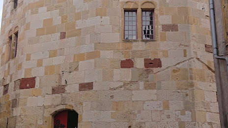
Musée de la Tour aux Puces — local attraction, which is located at Cr du Château, 57100 Thionville, France and belongs to the category — museum. Average visitor rating for this place — 4.5 (according to 67 ratings, information from open sources and relevant for 2022).
Exact location — Musée de la Tour aux Puces, marked on the map with a red marker.
You can get directions to Musée de la Tour aux Puces on the map from your location.
What else is interesting in Thionville? You can see all the sights if you go to the city page.
Coordinates
Musée de la Tour aux Puces, France coordinates in decimal format: latitude — 49.35788213318754, longitude — 6.169040325241572. When converted to degrees, minutes, seconds Musée de la Tour aux Puces has the following coordinates: 49°21′28.38 north latitude and 6°10′8.55 east longitude.
Nearby cities
The largest cities that are located nearby:
- Metz — 26 km
- Trier
 (Germany) — 55 km
 - Saarbrücken (Germany) — 61 km
- Nancy — 74 km
- Strasbourg — 145 km
- Liège
 (Belgium) — 147 km
 - Koblenz (Germany) — 149 km
- Namur (Belgium) — 153 km
- Reims — 155 km
- Aachen (Germany) — 157 km
- Mainz (Germany) — 164 km
- Ludwigshafen (Germany) — 164 km
- Mannheim (Germany) — 166 km
- Bonn (Germany) — 166 km
- Karlsruhe (Germany) — 167 km
- Wiesbaden (Germany) — 167 km
- Charleroi (Belgium) — 168 km
- Maastricht
 (Netherlands) — 168 km
 - Heidelberg (Germany) — 180 km
Distance to the capital
Distance to the capital (Paris) is about — 283 km.