
 Maureville
Samoëns
Gréning
Toulouse
Volx
Goudet
Méhoncourt
Saint-Hymer
Pontcarré
Maureville
Samoëns
Gréning
Toulouse
Volx
Goudet
Méhoncourt
Saint-Hymer
Pontcarré
Chapelle Saint-Nicolas de Morlange-lès-Rémelange on the map, Thionville, France
Photo
Where is located Chapelle Saint-Nicolas de Morlange-lès-Rémelange
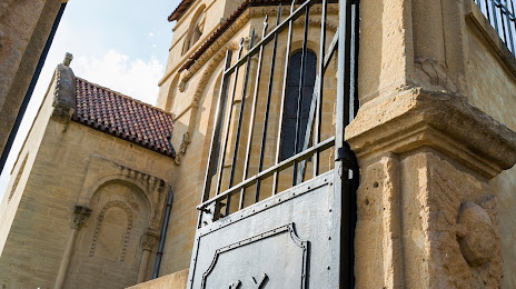
Chapelle Saint-Nicolas de Morlange-lès-Rémelange — local attraction, which is located at 121 Rue Saint-Roch, 57290 Fameck, France and belongs to the category — chapel. Average visitor rating for this place — 4.2 (according to 10 ratings, information from open sources and relevant for 2022).
Exact location — Chapelle Saint-Nicolas de Morlange-lès-Rémelange, marked on the map with a red marker.
You can get directions to Chapelle Saint-Nicolas de Morlange-lès-Rémelange on the map from your location.
What else is interesting in Thionville? You can see all the sights if you go to the city page.
Coordinates
Chapelle Saint-Nicolas de Morlange-lès-Rémelange, France coordinates in decimal format: latitude — 49.306889100590006, longitude — 6.085319125239749. When converted to degrees, minutes, seconds Chapelle Saint-Nicolas de Morlange-lès-Rémelange has the following coordinates: 49°18′24.8 north latitude and 6°5′7.15 east longitude.
Nearby cities
The largest cities that are located nearby:
- Metz — 26 km
- Trier
 (Germany) — 55 km
 - Saarbrücken (Germany) — 61 km
- Nancy — 74 km
- Strasbourg — 145 km
- Liège
 (Belgium) — 147 km
 - Koblenz (Germany) — 149 km
- Namur (Belgium) — 153 km
- Reims — 155 km
- Aachen (Germany) — 157 km
- Mainz (Germany) — 164 km
- Ludwigshafen (Germany) — 164 km
- Mannheim (Germany) — 166 km
- Bonn (Germany) — 166 km
- Karlsruhe (Germany) — 167 km
- Wiesbaden (Germany) — 167 km
- Charleroi (Belgium) — 168 km
- Maastricht
 (Netherlands) — 168 km
 - Heidelberg (Germany) — 180 km
Distance to the capital
Distance to the capital (Paris) is about — 277 km.