
 Maureville
Samoëns
Gréning
Toulouse
Volx
Goudet
Méhoncourt
Saint-Hymer
Pontcarré
Maureville
Samoëns
Gréning
Toulouse
Volx
Goudet
Méhoncourt
Saint-Hymer
Pontcarré
The Parc des Combes (Parc Des Combes) on the map, Le Creusot, France
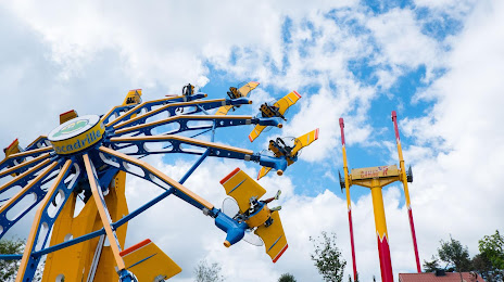
Photo
Where is located The Parc des Combes (Parc Des Combes)
The Parc des Combes (Parc Des Combes) — local attraction, which is located at Rue des Pyrénées, 71200 Le Creusot, France and belongs to the category — amusement park. Average visitor rating for this place — 4.3 (according to 1925 ratings, information from open sources and relevant for 2022).
Exact location — The Parc des Combes (Parc Des Combes), marked on the map with a red marker.
You can get directions to The Parc des Combes (Parc Des Combes) on the map from your location.
What else is interesting in Le Creusot? You can see all the sights if you go to the city page.
Coordinates
The Parc des Combes (Parc Des Combes), France coordinates in decimal format: latitude — 46.811594736502094, longitude — 4.4131369251525285. When converted to degrees, minutes, seconds The Parc des Combes (Parc Des Combes) has the following coordinates: 46°48′41.74 north latitude and 4°24′47.29 east longitude.
Nearby cities
The largest cities that are located nearby:
- Dijon — 73 km
- Lyon — 119 km
- Villeurbanne — 120 km
- Besançon — 129 km
- Geneva
 (Switzerland) — 147 km
 - Saint-Étienne — 151 km
- Clermont-Ferrand — 154 km
- Lausanne (Switzerland) — 171 km
- Grenoble — 205 km
- Orléans — 223 km
- Bern (Switzerland) — 228 km
- Mulhouse — 240 km
- Nancy — 245 km
- Basel (Switzerland) — 251 km
- Limoges — 267 km
- Reims — 273 km
- Boulogne-Billancourt — 276 km
- Freiburg
 (Germany) — 285 km
 - Metz — 285 km
Distance to the capital
Distance to the capital (Paris) is about — 275 km.