
 Maureville
Samoëns
Gréning
Toulouse
Volx
Goudet
Méhoncourt
Saint-Hymer
Pontcarré
Maureville
Samoëns
Gréning
Toulouse
Volx
Goudet
Méhoncourt
Saint-Hymer
Pontcarré
Musée du pain d'épices et de l'art populaire alsacien on the map, Obernai, France
Photo
Where is located Musée du pain d'épices et de l'art populaire alsacien
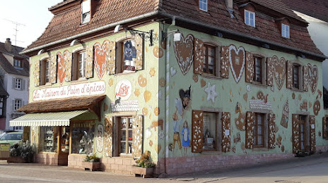
Musée du pain d'épices et de l'art populaire alsacien — local attraction, which is located at 110 Rue Principale, 67140 Gertwiller, France and belongs to the category — museum. Average visitor rating for this place — 4.3 (according to 1339 ratings, information from open sources and relevant for 2022).
Exact location — Musée du pain d'épices et de l'art populaire alsacien, marked on the map with a red marker.
You can get directions to Musée du pain d'épices et de l'art populaire alsacien on the map from your location.
What else is interesting in Obernai? You can see all the sights if you go to the city page.
Coordinates
Musée du pain d'épices et de l'art populaire alsacien, France coordinates in decimal format: latitude — 48.41120753211993, longitude — 7.467927425207984. When converted to degrees, minutes, seconds Musée du pain d'épices et de l'art populaire alsacien has the following coordinates: 48°24′40.35 north latitude and 7°28′4.54 east longitude.
Nearby cities
The largest cities that are located nearby:
- Strasbourg — 23 km
- Freiburg
 (Germany) — 58 km
 - Mulhouse — 79 km
- Karlsruhe (Germany) — 90 km
- Saarbrücken (Germany) — 93 km
- Nancy — 98 km
- Basel
 (Switzerland) — 99 km
 - Pforzheim (Germany) — 100 km
- Metz — 119 km
- Reutlingen (Germany) — 126 km
- Stuttgart (Germany) — 129 km
- Ludwigshafen (Germany) — 132 km
- Mannheim (Germany) — 134 km
- Heidelberg (Germany) — 134 km
- Zurich (Switzerland) — 145 km
- Heilbronn (Germany) — 146 km
- Trier (Germany) — 155 km
- Bern (Switzerland) — 167 km
- Besançon — 174 km
Distance to the capital
Distance to the capital (Paris) is about — 379 km.