
 Maureville
Samoëns
Gréning
Toulouse
Volx
Goudet
Méhoncourt
Saint-Hymer
Pontcarré
Maureville
Samoëns
Gréning
Toulouse
Volx
Goudet
Méhoncourt
Saint-Hymer
Pontcarré
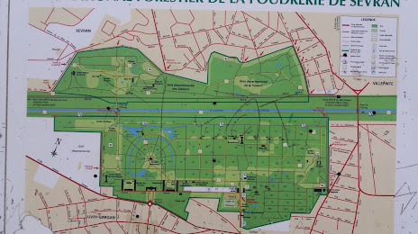
Parc Forestier National de la Poudrerie de Sevran Livry on the map, Sevran, France
Photo
Where is located Parc Forestier National de la Poudrerie de Sevran Livry
Parc Forestier National de la Poudrerie de Sevran Livry — local attraction, which is located at 93420 Villepinte, France and belongs to the category — park. Average visitor rating for this place — 4.4 (according to 1651 rating, information from open sources and relevant for 2022).
Exact location — Parc Forestier National de la Poudrerie de Sevran Livry, marked on the map with a red marker.
You can get directions to Parc Forestier National de la Poudrerie de Sevran Livry on the map from your location.
What else is interesting in Sevran? You can see all the sights if you go to the city page.
Coordinates
Parc Forestier National de la Poudrerie de Sevran Livry, France coordinates in decimal format: latitude — 48.93855886587699, longitude — 2.5588157252266392. When converted to degrees, minutes, seconds Parc Forestier National de la Poudrerie de Sevran Livry has the following coordinates: 48°56′18.81 north latitude and 2°33′31.74 east longitude.
Nearby cities
The largest cities that are located nearby:
- Boulogne-Billancourt — 24 km
- Amiens — 107 km
- Reims — 113 km
- Rouen — 118 km
- Orléans — 124 km
- Le Havre — 185 km
- Lille — 190 km
- Le Mans — 201 km
- Charleroi
 (Belgium) — 211 km
 - Caen — 212 km
- Tours — 220 km
- Namur (Belgium) — 236 km
- Brussels (Belgium) — 246 km
- Eastbourne
 (United Kingdom) — 256 km
 - Dijon — 259 km
- Metz — 264 km
- Nancy — 267 km
- Angers — 283 km
- Antwerp (Belgium) — 283 km
Distance to the capital
Distance to the capital (Paris) is about — 18 km.