
 Maureville
Samoëns
Gréning
Toulouse
Volx
Goudet
Méhoncourt
Saint-Hymer
Pontcarré
Maureville
Samoëns
Gréning
Toulouse
Volx
Goudet
Méhoncourt
Saint-Hymer
Pontcarré
Les Cavaliers on the map, Anglet, France
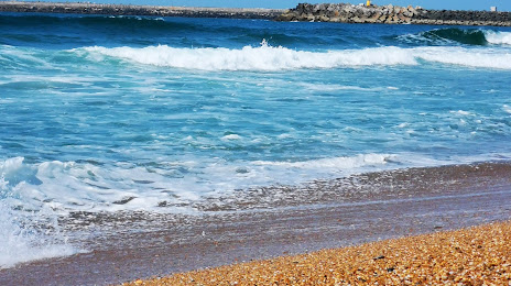
Photo
Where is located Les Cavaliers
Les Cavaliers — local attraction, which is located at no data and belongs to the category — -. Average visitor rating for this place — 4.6 (according to 82 ratings, information from open sources and relevant for 2022).
Exact location — Les Cavaliers, marked on the map with a red marker.
You can get directions to Les Cavaliers on the map from your location.
What else is interesting in Anglet? You can see all the sights if you go to the city page.
Coordinates
Les Cavaliers, France coordinates in decimal format: latitude — 43.520616548662964, longitude — -1.5276014538141445. When converted to degrees, minutes, seconds Les Cavaliers has the following coordinates: 43°31′14.22 north latitude and -1°31′39.37 east longitude.
Nearby cities
The largest cities that are located nearby:
- San Sebastián
 (Spain) — 42 km
 - Pamplona (Spain) — 75 km
- Bilbao (Spain) — 117 km
- Vitoria-Gasteiz (Spain) — 117 km
- Logroño (Spain) — 136 km
- Bordeaux — 167 km
- Santander (Spain) — 184 km
- Zaragoza (Spain) — 209 km
- Burgos (Spain) — 218 km
- Toulouse — 237 km
- Lleida (Spain) — 271 km
- Gijón (Spain) — 332 km
- Valladolid (Spain) — 333 km
- Limoges — 337 km
- León (Spain) — 344 km
- Tarragona (Spain) — 348 km
- Oviedo (Spain) — 349 km
- Terrassa (Spain) — 360 km
- Alcala de Henares (Spain) — 366 km
Distance to the capital
Distance to the capital (Paris) is about — 664 km.