
 Maureville
Samoëns
Gréning
Toulouse
Volx
Goudet
Méhoncourt
Saint-Hymer
Pontcarré
Maureville
Samoëns
Gréning
Toulouse
Volx
Goudet
Méhoncourt
Saint-Hymer
Pontcarré
Tour des Arquets on the map, Cambrai, France
Photo
Where is located Tour des Arquets
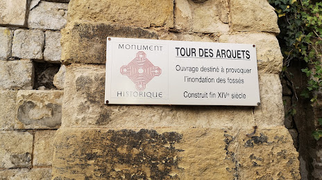
Tour des Arquets — local attraction, which is located at 4 Rue de la Tour des Arquets, 59400 Cambrai, France and belongs to the category — historical landmark. Average visitor rating for this place — 4.0 (according to 1 rating, information from open sources and relevant for 2022).
Exact location — Tour des Arquets, marked on the map with a red marker.
You can get directions to Tour des Arquets on the map from your location.
What else is interesting in Cambrai? You can see all the sights if you go to the city page.
Coordinates
Tour des Arquets, France coordinates in decimal format: latitude — 50.17494405888684, longitude — 3.2228486252708355. When converted to degrees, minutes, seconds Tour des Arquets has the following coordinates: 50°10′29.8 north latitude and 3°13′22.26 east longitude.
Nearby cities
The largest cities that are located nearby:
- Lille — 52 km
- Amiens — 74 km
- Charleroi
 (Belgium) — 89 km
 - Brussels (Belgium) — 108 km
- Reims — 116 km
- Namur (Belgium) — 120 km
- Antwerp (Belgium) — 141 km
- Boulogne-Billancourt — 164 km
- Liège (Belgium) — 172 km
- Rouen — 174 km
- Maastricht
 (Netherlands) — 187 km
 - Breda (Netherlands) — 188 km
- Tilburg (Netherlands) — 199 km
- Dordrecht (Netherlands) — 207 km
- Eindhoven (Netherlands) — 208 km
- Aachen
 (Germany) — 210 km
 - Rotterdam (Netherlands) — 211 km
- Eastbourne
 (United Kingdom) — 216 km
 - 's-Hertogenbosch (Netherlands) — 220 km
Distance to the capital
Distance to the capital (Paris) is about — 160 km.