
 Maureville
Samoëns
Gréning
Toulouse
Volx
Goudet
Méhoncourt
Saint-Hymer
Pontcarré
Maureville
Samoëns
Gréning
Toulouse
Volx
Goudet
Méhoncourt
Saint-Hymer
Pontcarré
Canal de Saint-Quentin on the map, Cambrai, France
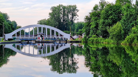
Photo
Where is located Canal de Saint-Quentin
Canal de Saint-Quentin — local attraction, which is located at France and belongs to the category — -. Average visitor rating for this place — 4.2 (according to 50 ratings, information from open sources and relevant for 2022).
Exact location — Canal de Saint-Quentin, marked on the map with a red marker.
You can get directions to Canal de Saint-Quentin on the map from your location.
What else is interesting in Cambrai? You can see all the sights if you go to the city page.
Coordinates
Canal de Saint-Quentin, France coordinates in decimal format: latitude — 50.0967526687478, longitude — 3.2186043657782273. When converted to degrees, minutes, seconds Canal de Saint-Quentin has the following coordinates: 50°5′48.31 north latitude and 3°13′6.98 east longitude.
Nearby cities
The largest cities that are located nearby:
- Lille — 52 km
- Amiens — 74 km
- Charleroi
 (Belgium) — 89 km
 - Brussels (Belgium) — 108 km
- Reims — 116 km
- Namur (Belgium) — 120 km
- Antwerp (Belgium) — 141 km
- Boulogne-Billancourt — 164 km
- Liège (Belgium) — 172 km
- Rouen — 174 km
- Maastricht
 (Netherlands) — 187 km
 - Breda (Netherlands) — 188 km
- Tilburg (Netherlands) — 199 km
- Dordrecht (Netherlands) — 207 km
- Eindhoven (Netherlands) — 208 km
- Aachen
 (Germany) — 210 km
 - Rotterdam (Netherlands) — 211 km
- Eastbourne
 (United Kingdom) — 216 km
 - 's-Hertogenbosch (Netherlands) — 220 km
Distance to the capital
Distance to the capital (Paris) is about — 151 km.