
 Maureville
Samoëns
Gréning
Toulouse
Volx
Goudet
Méhoncourt
Saint-Hymer
Pontcarré
Maureville
Samoëns
Gréning
Toulouse
Volx
Goudet
Méhoncourt
Saint-Hymer
Pontcarré
Église Saint Michel on the map, Draguignan, France
Photo
Where is located Église Saint Michel
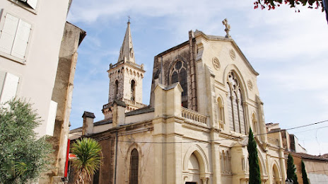
Église Saint Michel — local attraction, which is located at Pl. de la Paroisse, 83300 Draguignan, France and belongs to the category — catholic church. Average visitor rating for this place — 4.4 (according to 78 ratings, information from open sources and relevant for 2022).
Exact location — Église Saint Michel, marked on the map with a red marker.
You can get directions to Église Saint Michel on the map from your location.
What else is interesting in Draguignan? You can see all the sights if you go to the city page.
Coordinates
Église Saint Michel, France coordinates in decimal format: latitude — 43.53891188081236, longitude — 6.4652703250434245. When converted to degrees, minutes, seconds Église Saint Michel has the following coordinates: 43°32′20.08 north latitude and 6°27′54.97 east longitude.
Nearby cities
The largest cities that are located nearby:
- Toulon — 63 km
- Nice — 66 km
- Aix-en-Provence — 82 km
- Marseille — 92 km
- Nimes — 171 km
- Grenoble — 191 km
- Turin
 (Italy) — 194 km
 - Montpellier — 207 km
- Genoa (Italy) — 218 km
- Saint-Étienne — 265 km
- Novara (Italy) — 269 km
- Villeurbanne — 275 km
- Lyon — 276 km
- Geneva
 (Switzerland) — 295 km
 - Milan (Italy) — 300 km
- Perpignan — 305 km
- Livorno (Italy) — 308 km
- Monza (Italy) — 314 km
- Lausanne (Switzerland) — 330 km
Distance to the capital
Distance to the capital (Paris) is about — 671 km.