
 Maureville
Samoëns
Gréning
Toulouse
Volx
Goudet
Méhoncourt
Saint-Hymer
Pontcarré
Maureville
Samoëns
Gréning
Toulouse
Volx
Goudet
Méhoncourt
Saint-Hymer
Pontcarré
Abbaye de Fontaine-Daniel on the map, Mayenne, France
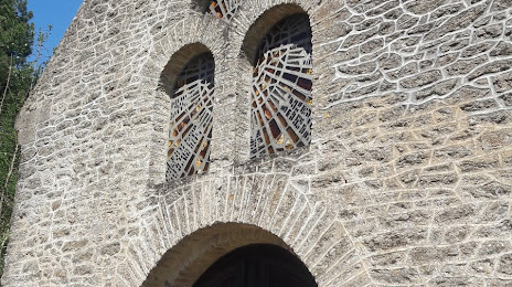
Photo
Where is located Abbaye de Fontaine-Daniel
Abbaye de Fontaine-Daniel — local attraction, which is located at Chem. de l'Abbaye, 53100 Saint-Georges-Buttavent, France and belongs to the category — historical landmark. Average visitor rating for this place — 5.0 (according to 1 rating, information from open sources and relevant for 2022).
Exact location — Abbaye de Fontaine-Daniel, marked on the map with a red marker.
You can get directions to Abbaye de Fontaine-Daniel on the map from your location.
What else is interesting in Mayenne? You can see all the sights if you go to the city page.
Coordinates
Abbaye de Fontaine-Daniel, France coordinates in decimal format: latitude — 48.277606347995835, longitude — -0.673277274796682. When converted to degrees, minutes, seconds Abbaye de Fontaine-Daniel has the following coordinates: 48°16′39.38 north latitude and -0°40′23.8 east longitude.
Nearby cities
The largest cities that are located nearby:
- Le Mans — 69 km
- Rennes — 81 km
- Angers — 92 km
- Caen — 99 km
- Nantes — 139 km
- Tours — 140 km
- Le Havre — 141 km
- Rouen — 176 km
- Orléans — 193 km
- Boulogne-Billancourt — 216 km
- Amiens — 272 km
- Eastbourne
 (United Kingdom) — 280 km
 - Portsmouth (United Kingdom) — 280 km
- Bournemouth (United Kingdom) — 281 km
- Brest — 284 km
- Southampton (United Kingdom) — 293 km
- Limoges — 309 km
- Crawley (United Kingdom) — 311 km
- Exeter (United Kingdom) — 336 km
Distance to the capital
Distance to the capital (Paris) is about — 232 km.