
 Maureville
Samoëns
Gréning
Toulouse
Volx
Goudet
Méhoncourt
Saint-Hymer
Pontcarré
Maureville
Samoëns
Gréning
Toulouse
Volx
Goudet
Méhoncourt
Saint-Hymer
Pontcarré
Châteaudun Château Park & Gardens on the map, Châteaudun, France
Photo
Where is located Châteaudun Château Park & Gardens
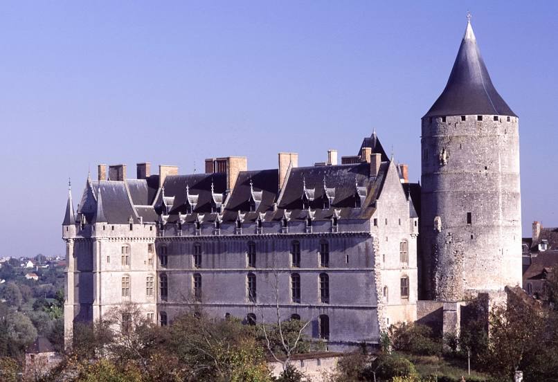
Châteaudun Château Park & Gardens — local attraction, which is located at Pl. Jehan de Dunois, 28200 Châteaudun, France and belongs to the category — castle. Average visitor rating for this place — 4.3 (according to 1224 ratings, information from open sources and relevant for 2022).
Exact location — Châteaudun Château Park & Gardens, marked on the map with a red marker.
You can get directions to Châteaudun Château Park & Gardens on the map from your location.
What else is interesting in Châteaudun? You can see all the sights if you go to the city page.
Coordinates
Châteaudun Château Park & Gardens, France coordinates in decimal format: latitude — 48.070787823120476, longitude — 1.3185831845928522. When converted to degrees, minutes, seconds Châteaudun Château Park & Gardens has the following coordinates: 48°4′14.84 north latitude and 1°19′6.9 east longitude.
Nearby cities
The largest cities that are located nearby:
- Orléans — 47 km
- Le Mans — 84 km
- Tours — 89 km
- Boulogne-Billancourt — 108 km
- Rouen — 153 km
- Angers — 156 km
- Caen — 174 km
- Le Havre — 180 km
- Amiens — 213 km
- Rennes — 222 km
- Reims — 235 km
- Nantes — 236 km
- Limoges — 247 km
- Clermont-Ferrand — 288 km
- Dijon — 290 km
- Eastbourne
 (United Kingdom) — 307 km
 - Lille — 308 km
- Charleroi
 (Belgium) — 339 km
 - Portsmouth (United Kingdom) — 348 km
Distance to the capital
Distance to the capital (Paris) is about — 116 km.