
 Maureville
Samoëns
Gréning
Toulouse
Volx
Goudet
Méhoncourt
Saint-Hymer
Pontcarré
Maureville
Samoëns
Gréning
Toulouse
Volx
Goudet
Méhoncourt
Saint-Hymer
Pontcarré
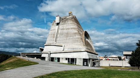
Saint-Pierre on the map, Firminy, France
Photo
Where is located Saint-Pierre
Saint-Pierre — local attraction, which is located at 29 Rue des Noyers, 42700 Firminy, France and belongs to the category — building. Average visitor rating for this place — 4.3 (according to 231 rating, information from open sources and relevant for 2022).
Exact location — Saint-Pierre, marked on the map with a red marker.
You can get directions to Saint-Pierre on the map from your location.
What else is interesting in Firminy? You can see all the sights if you go to the city page.
Coordinates
Saint-Pierre, France coordinates in decimal format: latitude — 45.383577169476446, longitude — 4.286324525104177. When converted to degrees, minutes, seconds Saint-Pierre has the following coordinates: 45°23′0.88 north latitude and 4°17′10.77 east longitude.
Nearby cities
The largest cities that are located nearby:
- Saint-Étienne — 10 km
- Lyon — 59 km
- Villeurbanne — 63 km
- Clermont-Ferrand — 102 km
- Grenoble — 114 km
- Geneva
 (Switzerland) — 168 km
 - Nimes — 172 km
- Montpellier — 199 km
- Lausanne (Switzerland) — 218 km
- Dijon — 221 km
- Aix-en-Provence — 225 km
- Limoges — 238 km
- Besançon — 243 km
- Marseille — 247 km
- Turin
 (Italy) — 268 km
 - Toulon — 283 km
- Bern (Switzerland) — 294 km
- Toulouse — 301 km
- Nice — 301 km
Distance to the capital
Distance to the capital (Paris) is about — 413 km.