
 Maureville
Samoëns
Gréning
Toulouse
Volx
Goudet
Méhoncourt
Saint-Hymer
Pontcarré
Maureville
Samoëns
Gréning
Toulouse
Volx
Goudet
Méhoncourt
Saint-Hymer
Pontcarré
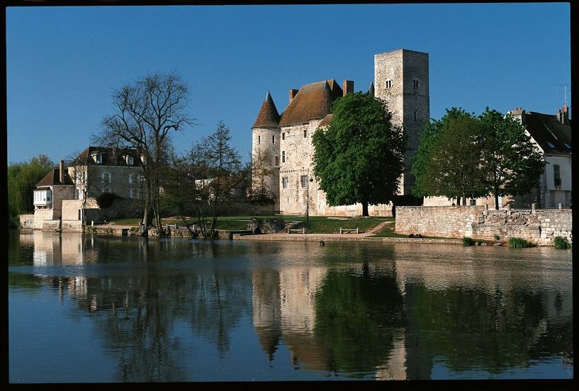
Château de Nemours on the map, Nemours, France
Photo
Where is located Château de Nemours
Château de Nemours — local attraction, which is located at Cour du Château, 1 Rue Gautier 1er, 77140 Nemours, France and belongs to the category — museum. Average visitor rating for this place — 4.2 (according to 428 ratings, information from open sources and relevant for 2022).
Exact location — Château de Nemours, marked on the map with a red marker.
You can get directions to Château de Nemours on the map from your location.
What else is interesting in Nemours? You can see all the sights if you go to the city page.
Coordinates
Château de Nemours, France coordinates in decimal format: latitude — 48.26550174038242, longitude — 2.697047025202908. When converted to degrees, minutes, seconds Château de Nemours has the following coordinates: 48°15′55.81 north latitude and 2°41′49.37 east longitude.
Nearby cities
The largest cities that are located nearby:
- Orléans — 71 km
- Boulogne-Billancourt — 71 km
- Reims — 146 km
- Rouen — 173 km
- Tours — 179 km
- Amiens — 182 km
- Le Mans — 187 km
- Dijon — 205 km
- Le Havre — 230 km
- Caen — 243 km
- Angers — 258 km
- Nancy — 259 km
- Lille — 262 km
- Charleroi
 (Belgium) — 267 km
 - Metz — 269 km
- Besançon — 275 km
- Clermont-Ferrand — 277 km
- Namur (Belgium) — 288 km
- Limoges — 291 km
Distance to the capital
Distance to the capital (Paris) is about — 70 km.