
 Maureville
Samoëns
Gréning
Toulouse
Volx
Goudet
Méhoncourt
Saint-Hymer
Pontcarré
Maureville
Samoëns
Gréning
Toulouse
Volx
Goudet
Méhoncourt
Saint-Hymer
Pontcarré
Lac Des Peupleraies on the map, Saint-Avertin, France
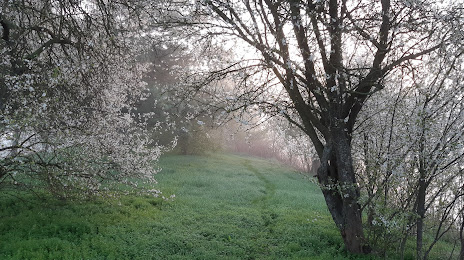
Photo
Where is located Lac Des Peupleraies
Lac Des Peupleraies — local attraction, which is located at Quai Georges Vallerey, 37000 Tours, France and belongs to the category — hiking area. Average visitor rating for this place — 4.3 (according to 12 ratings, information from open sources and relevant for 2022).
Exact location — Lac Des Peupleraies, marked on the map with a red marker.
You can get directions to Lac Des Peupleraies on the map from your location.
What else is interesting in Saint-Avertin? You can see all the sights if you go to the city page.
Coordinates
Lac Des Peupleraies, France coordinates in decimal format: latitude — 47.3735359750771, longitude — 0.7338201967022452. When converted to degrees, minutes, seconds Lac Des Peupleraies has the following coordinates: 47°22′24.73 north latitude and 0°44′1.75 east longitude.
Nearby cities
The largest cities that are located nearby:
- Tours — 4 km
- Le Mans — 81 km
- Angers — 97 km
- Orléans — 106 km
- Nantes — 172 km
- Limoges — 175 km
- Rennes — 196 km
- Boulogne-Billancourt — 196 km
- Caen — 216 km
- Rouen — 231 km
- Le Havre — 239 km
- Clermont-Ferrand — 253 km
- Bordeaux — 298 km
- Amiens — 301 km
- Reims — 317 km
- Dijon — 323 km
- Saint-Étienne — 355 km
- Lyon — 363 km
- Villeurbanne — 366 km
Distance to the capital
Distance to the capital (Paris) is about — 204 km.