
 Maureville
Samoëns
Gréning
Toulouse
Volx
Goudet
Méhoncourt
Saint-Hymer
Pontcarré
Maureville
Samoëns
Gréning
Toulouse
Volx
Goudet
Méhoncourt
Saint-Hymer
Pontcarré
Cap Canaille on the map, La Ciotat, France
Photo
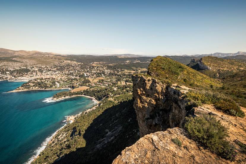
Where is located Cap Canaille
Cap Canaille — local attraction, which is located at no data and belongs to the category — -. Average visitor rating for this place — 4.8 (according to 169 ratings, information from open sources and relevant for 2022).
Exact location — Cap Canaille, marked on the map with a red marker.
You can get directions to Cap Canaille on the map from your location.
What else is interesting in La Ciotat? You can see all the sights if you go to the city page.
Coordinates
Cap Canaille, France coordinates in decimal format: latitude — 43.19360553061816, longitude — 5.552817890541393. When converted to degrees, minutes, seconds Cap Canaille has the following coordinates: 43°11′36.98 north latitude and 5°33′10.14 east longitude.
Nearby cities
The largest cities that are located nearby:
- Marseille — 23 km
- Toulon — 27 km
- Aix-en-Provence — 41 km
- Nimes — 123 km
- Nice — 145 km
- Montpellier — 147 km
- Grenoble — 223 km
- Perpignan — 227 km
- Turin
 (Italy) — 265 km
 - Saint-Étienne — 268 km
- Lyon — 292 km
- Villeurbanne — 293 km
- Genoa (Italy) — 297 km
- Mataró
 (Spain) — 318 km
 - Toulouse — 337 km
- Geneva
 (Switzerland) — 337 km
 - Badalona (Spain) — 338 km
- Santa Coloma de Gramenet (Spain) — 340 km
- Sabadell (Spain) — 341 km
Distance to the capital
Distance to the capital (Paris) is about — 676 km.