
 Maureville
Samoëns
Gréning
Toulouse
Volx
Goudet
Méhoncourt
Saint-Hymer
Pontcarré
Maureville
Samoëns
Gréning
Toulouse
Volx
Goudet
Méhoncourt
Saint-Hymer
Pontcarré
Château de Nantouillet on the map, Villeparisis, France
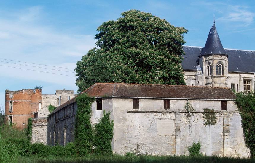
Photo
Where is located Château de Nantouillet
Château de Nantouillet — local attraction, which is located at 77230 Nantouillet, France and belongs to the category — château. Average visitor rating for this place — 4.0 (according to 21 rating, information from open sources and relevant for 2022).
Exact location — Château de Nantouillet, marked on the map with a red marker.
You can get directions to Château de Nantouillet on the map from your location.
What else is interesting in Villeparisis? You can see all the sights if you go to the city page.
Coordinates
Château de Nantouillet, France coordinates in decimal format: latitude — 49.00219700633578, longitude — 2.704174425228913. When converted to degrees, minutes, seconds Château de Nantouillet has the following coordinates: 49°0′7.91 north latitude and 2°42′15.03 east longitude.
Nearby cities
The largest cities that are located nearby:
- Boulogne-Billancourt — 29 km
- Amiens — 108 km
- Reims — 108 km
- Rouen — 122 km
- Orléans — 126 km
- Lille — 190 km
- Le Havre — 190 km
- Le Mans — 206 km
- Charleroi
 (Belgium) — 208 km
 - Caen — 217 km
- Tours — 224 km
- Namur (Belgium) — 232 km
- Brussels (Belgium) — 244 km
- Dijon — 255 km
- Metz — 258 km
- Eastbourne
 (United Kingdom) — 259 km
 - Nancy — 262 km
- Liège (Belgium) — 280 km
- Antwerp (Belgium) — 281 km
Distance to the capital
Distance to the capital (Paris) is about — 30 km.