
 Maureville
Samoëns
Gréning
Toulouse
Volx
Goudet
Méhoncourt
Saint-Hymer
Pontcarré
Maureville
Samoëns
Gréning
Toulouse
Volx
Goudet
Méhoncourt
Saint-Hymer
Pontcarré
Chère on the map, Châteaubriant, France
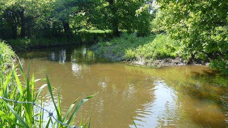
Photo
Where is located Chère
Chère — local attraction, which is located at 65 km and belongs to the category — -. Average visitor rating for this place — 4.2 (according to 132 ratings, information from open sources and relevant for 2022).
Exact location — Chère, marked on the map with a red marker.
You can get directions to Chère on the map from your location.
What else is interesting in Châteaubriant? You can see all the sights if you go to the city page.
Coordinates
Chère, France coordinates in decimal format: latitude — 47.71888930674012, longitude — -1.393226778280004. When converted to degrees, minutes, seconds Chère has the following coordinates: 47°43′8 north latitude and -1°23′35.62 east longitude.
Nearby cities
The largest cities that are located nearby:
- Rennes — 49 km
- Nantes — 57 km
- Angers — 66 km
- Le Mans — 121 km
- Tours — 158 km
- Caen — 177 km
- Le Havre — 223 km
- Brest — 240 km
- Orléans — 244 km
- Rouen — 261 km
- Boulogne-Billancourt — 291 km
- Limoges — 291 km
- Bordeaux — 325 km
- Bournemouth
 (United Kingdom) — 333 km
 - Portsmouth (United Kingdom) — 343 km
- Southampton (United Kingdom) — 353 km
- Amiens — 355 km
- Eastbourne (United Kingdom) — 356 km
- Exeter (United Kingdom) — 364 km
Distance to the capital
Distance to the capital (Paris) is about — 305 km.