
 Maureville
Samoëns
Gréning
Toulouse
Volx
Goudet
Méhoncourt
Saint-Hymer
Pontcarré
Maureville
Samoëns
Gréning
Toulouse
Volx
Goudet
Méhoncourt
Saint-Hymer
Pontcarré
Étang de Scamandre on the map, Vauvert, France
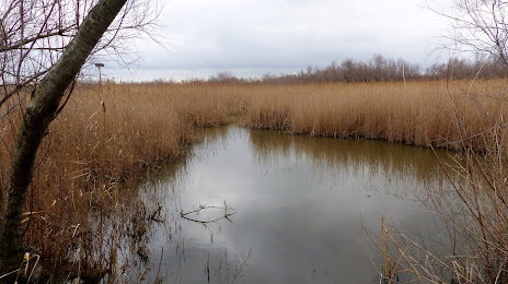
Photo
Where is located Étang de Scamandre
Étang de Scamandre — local attraction, which is located at no data and belongs to the category — -. Average visitor rating for this place — 4.5 (according to 22 ratings, information from open sources and relevant for 2022).
Exact location — Étang de Scamandre, marked on the map with a red marker.
You can get directions to Étang de Scamandre on the map from your location.
What else is interesting in Vauvert? You can see all the sights if you go to the city page.
Coordinates
Étang de Scamandre, France coordinates in decimal format: latitude — 43.62325046981516, longitude — 4.35804144143471. When converted to degrees, minutes, seconds Étang de Scamandre has the following coordinates: 43°37′23.7 north latitude and 4°21′28.95 east longitude.
Nearby cities
The largest cities that are located nearby:
- Nimes — 17 km
- Montpellier — 33 km
- Aix-en-Provence — 95 km
- Marseille — 98 km
- Toulon — 147 km
- Perpignan — 158 km
- Saint-Étienne — 193 km
- Grenoble — 200 km
- Toulouse — 227 km
- Lyon — 233 km
- Villeurbanne — 235 km
- Nice — 238 km
- Clermont-Ferrand — 248 km
- Mataró
 (Spain) — 282 km
 - Sabadell (Spain) — 298 km
- Badalona (Spain) — 300 km
- Terrassa (Spain) — 301 km
- Santa Coloma de Gramenet (Spain) — 302 km
- Turin
 (Italy) — 307 km
Distance to the capital
Distance to the capital (Paris) is about — 602 km.