
 Maureville
Samoëns
Gréning
Toulouse
Volx
Goudet
Méhoncourt
Saint-Hymer
Pontcarré
Maureville
Samoëns
Gréning
Toulouse
Volx
Goudet
Méhoncourt
Saint-Hymer
Pontcarré
Forêt Régionale de Bréviande on the map, Savigny-le-Temple, France
Photo
Where is located Forêt Régionale de Bréviande
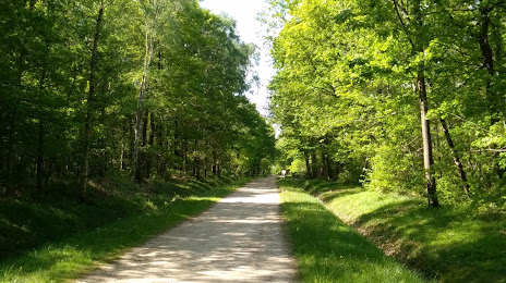
Forêt Régionale de Bréviande — local attraction, which is located at no data and belongs to the category — -. Average visitor rating for this place — 4.4 (according to 99 ratings, information from open sources and relevant for 2022).
Exact location — Forêt Régionale de Bréviande, marked on the map with a red marker.
You can get directions to Forêt Régionale de Bréviande on the map from your location.
What else is interesting in Savigny-le-Temple? You can see all the sights if you go to the city page.
Coordinates
Forêt Régionale de Bréviande, France coordinates in decimal format: latitude — 48.551746305444155, longitude — 2.6214737021703973. When converted to degrees, minutes, seconds Forêt Régionale de Bréviande has the following coordinates: 48°33′6.29 north latitude and 2°37′17.31 east longitude.
Nearby cities
The largest cities that are located nearby:
- Boulogne-Billancourt — 37 km
- Orléans — 91 km
- Reims — 128 km
- Rouen — 142 km
- Amiens — 145 km
- Le Mans — 188 km
- Tours — 194 km
- Le Havre — 203 km
- Caen — 223 km
- Lille — 227 km
- Dijon — 232 km
- Charleroi
 (Belgium) — 240 km
 - Namur (Belgium) — 262 km
- Nancy — 263 km
- Angers — 265 km
- Metz — 266 km
- Brussels (Belgium) — 278 km
- Eastbourne
 (United Kingdom) — 289 km
 - Besançon — 299 km
Distance to the capital
Distance to the capital (Paris) is about — 39 km.