
 Maureville
Samoëns
Gréning
Toulouse
Volx
Goudet
Méhoncourt
Saint-Hymer
Pontcarré
Maureville
Samoëns
Gréning
Toulouse
Volx
Goudet
Méhoncourt
Saint-Hymer
Pontcarré
Pic de Nore on the map, Mazamet, France
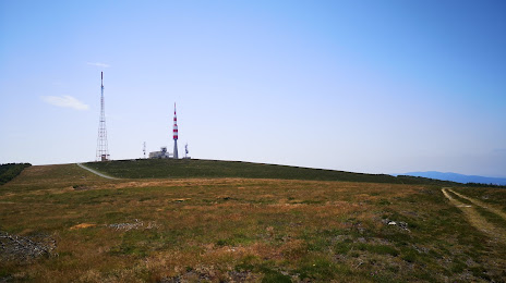
Photo
Where is located Pic de Nore
Pic de Nore — local attraction, which is located at 1,211 m and belongs to the category — -. Average visitor rating for this place — 4.7 (according to 214 ratings, information from open sources and relevant for 2022).
Exact location — Pic de Nore, marked on the map with a red marker.
You can get directions to Pic de Nore on the map from your location.
What else is interesting in Mazamet? You can see all the sights if you go to the city page.
Coordinates
Pic de Nore, France coordinates in decimal format: latitude — 43.423683643848726, longitude — 2.4624728910188924. When converted to degrees, minutes, seconds Pic de Nore has the following coordinates: 43°25′25.26 north latitude and 2°27′44.9 east longitude.
Nearby cities
The largest cities that are located nearby:
- Toulouse — 76 km
- Perpignan — 98 km
- Montpellier — 121 km
- Nimes — 163 km
- Terrassa
 (Spain) — 215 km
 - Mataró (Spain) — 216 km
- Sabadell (Spain) — 216 km
- Badalona (Spain) — 226 km
- Santa Coloma de Gramenet (Spain) — 227 km
- L'Hospitalet de Llobregat (Spain) — 236 km
- Marseille — 242 km
- Aix-en-Provence — 246 km
- Lleida (Spain) — 253 km
- Clermont-Ferrand — 259 km
- Saint-Étienne — 266 km
- Limoges — 273 km
- Bordeaux — 276 km
- Tarragona (Spain) — 279 km
- Toulon — 289 km
Distance to the capital
Distance to the capital (Paris) is about — 604 km.