
 Maureville
Samoëns
Gréning
Toulouse
Volx
Goudet
Méhoncourt
Saint-Hymer
Pontcarré
Maureville
Samoëns
Gréning
Toulouse
Volx
Goudet
Méhoncourt
Saint-Hymer
Pontcarré
Centre Régional Résistance et Liberté on the map, Thouars, France
Photo
Where is located Centre Régional Résistance et Liberté
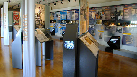
Centre Régional Résistance et Liberté — local attraction, which is located at Les écuries du château - Rond-point du 19 mars 1962, 79100 Thouars, France and belongs to the category — history museum. Average visitor rating for this place — 4.4 (according to 41 rating, information from open sources and relevant for 2022).
Exact location — Centre Régional Résistance et Liberté, marked on the map with a red marker.
You can get directions to Centre Régional Résistance et Liberté on the map from your location.
What else is interesting in Thouars? You can see all the sights if you go to the city page.
Coordinates
Centre Régional Résistance et Liberté, France coordinates in decimal format: latitude — 46.97186413510459, longitude — -0.2179670748419703. When converted to degrees, minutes, seconds Centre Régional Résistance et Liberté has the following coordinates: 46°58′18.71 north latitude and -0°13′4.68 east longitude.
Nearby cities
The largest cities that are located nearby:
- Angers — 61 km
- Tours — 82 km
- Nantes — 104 km
- Le Mans — 118 km
- Rennes — 166 km
- Limoges — 170 km
- Orléans — 188 km
- Bordeaux — 238 km
- Caen — 244 km
- Boulogne-Billancourt — 273 km
- Le Havre — 279 km
- Clermont-Ferrand — 287 km
- Rouen — 289 km
- Brest — 350 km
- Amiens — 369 km
- Saint-Étienne — 396 km
- Toulouse — 396 km
- Dijon — 396 km
- Reims — 397 km
Distance to the capital
Distance to the capital (Paris) is about — 284 km.