
 Maureville
Samoëns
Gréning
Toulouse
Volx
Goudet
Méhoncourt
Saint-Hymer
Pontcarré
Maureville
Samoëns
Gréning
Toulouse
Volx
Goudet
Méhoncourt
Saint-Hymer
Pontcarré
Plage d'Ondres on the map, Tarnos, France
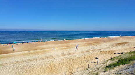
Photo
Where is located Plage d'Ondres
Plage d'Ondres — local attraction, which is located at no data and belongs to the category — -. Average visitor rating for this place — 4.3 (according to 101 rating, information from open sources and relevant for 2022).
Exact location — Plage d'Ondres, marked on the map with a red marker.
You can get directions to Plage d'Ondres on the map from your location.
What else is interesting in Tarnos? You can see all the sights if you go to the city page.
Coordinates
Plage d'Ondres, France coordinates in decimal format: latitude — 43.575469602038126, longitude — -1.4898613749553284. When converted to degrees, minutes, seconds Plage d'Ondres has the following coordinates: 43°34′31.69 north latitude and -1°29′23.5 east longitude.
Nearby cities
The largest cities that are located nearby:
- San Sebastián
 (Spain) — 49 km
 - Pamplona (Spain) — 82 km
- Bilbao (Spain) — 123 km
- Vitoria-Gasteiz (Spain) — 124 km
- Logroño (Spain) — 144 km
- Bordeaux — 159 km
- Santander (Spain) — 189 km
- Zaragoza (Spain) — 214 km
- Burgos (Spain) — 226 km
- Toulouse — 233 km
- Lleida (Spain) — 273 km
- Limoges — 329 km
- Gijón (Spain) — 337 km
- Valladolid (Spain) — 341 km
- Tarragona (Spain) — 350 km
- León (Spain) — 350 km
- Oviedo (Spain) — 353 km
- Terrassa (Spain) — 361 km
- Perpignan — 366 km
Distance to the capital
Distance to the capital (Paris) is about — 657 km.