
 Maureville
Samoëns
Gréning
Toulouse
Volx
Goudet
Méhoncourt
Saint-Hymer
Pontcarré
Maureville
Samoëns
Gréning
Toulouse
Volx
Goudet
Méhoncourt
Saint-Hymer
Pontcarré
Chapelle Sainte Hélène on the map, Douarnenez, France
Photo
Where is located Chapelle Sainte Hélène
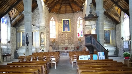
Chapelle Sainte Hélène — local attraction, which is located at Rue Anatole France, 29100 Douarnenez, France and belongs to the category — chapel. Average visitor rating for this place — 4.4 (according to 35 ratings, information from open sources and relevant for 2022).
Exact location — Chapelle Sainte Hélène, marked on the map with a red marker.
You can get directions to Chapelle Sainte Hélène on the map from your location.
What else is interesting in Douarnenez? You can see all the sights if you go to the city page.
Coordinates
Chapelle Sainte Hélène, France coordinates in decimal format: latitude — 48.09328743222385, longitude — -4.325802374803097. When converted to degrees, minutes, seconds Chapelle Sainte Hélène has the following coordinates: 48°5′35.83 north latitude and -4°19′32.89 east longitude.
Nearby cities
The largest cities that are located nearby:
- Brest — 35 km
- Rennes — 196 km
- Nantes — 230 km
- Angers — 289 km
- Exeter
 (United Kingdom) — 296 km
 - Caen — 310 km
- Le Mans — 335 km
- Bournemouth (United Kingdom) — 337 km
- Le Havre — 354 km
- Southampton (United Kingdom) — 372 km
- Portsmouth (United Kingdom) — 377 km
- Tours — 383 km
- Bristol (Great Britain) — 391 km
- Rouen — 418 km
- Swindon (United Kingdom) — 421 km
- Reading (United Kingdom) — 437 km
- Eastbourne (United Kingdom) — 438 km
- Crawley (United Kingdom) — 440 km
- Cheltenham (United Kingdom) — 448 km
Distance to the capital
Distance to the capital (Paris) is about — 500 km.