
 Maureville
Samoëns
Gréning
Toulouse
Volx
Goudet
Méhoncourt
Saint-Hymer
Pontcarré
Maureville
Samoëns
Gréning
Toulouse
Volx
Goudet
Méhoncourt
Saint-Hymer
Pontcarré
Forêt Domaniale de Montmorency on the map, Épinay-sur-Seine, France
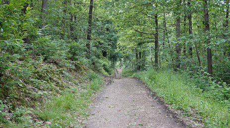
Photo
Where is located Forêt Domaniale de Montmorency
Forêt Domaniale de Montmorency — local attraction, which is located at France and belongs to the category — national forest. Average visitor rating for this place — 4.5 (according to 3539 ratings, information from open sources and relevant for 2022).
Exact location — Forêt Domaniale de Montmorency, marked on the map with a red marker.
You can get directions to Forêt Domaniale de Montmorency on the map from your location.
What else is interesting in Épinay-sur-Seine? You can see all the sights if you go to the city page.
Coordinates
Forêt Domaniale de Montmorency, France coordinates in decimal format: latitude — 48.953924893854854, longitude — 2.316125081213158. When converted to degrees, minutes, seconds Forêt Domaniale de Montmorency has the following coordinates: 48°57′14.13 north latitude and 2°18′58.05 east longitude.
Nearby cities
The largest cities that are located nearby:
- Boulogne-Billancourt — 14 km
- Rouen — 103 km
- Amiens — 104 km
- Orléans — 120 km
- Reims — 128 km
- Le Havre — 169 km
- Le Mans — 188 km
- Lille — 192 km
- Caen — 196 km
- Tours — 211 km
- Charleroi
 (Belgium) — 220 km
 - Eastbourne
 (United Kingdom) — 245 km
 - Namur (Belgium) — 246 km
- Brussels (Belgium) — 253 km
- Angers — 270 km
- Dijon — 273 km
- Metz — 280 km
- Nancy — 284 km
- Antwerp (Belgium) — 289 km
Distance to the capital
Distance to the capital (Paris) is about — 11 km.